
A Balancing Act In The Grand Canyon: The High Flow Experiments
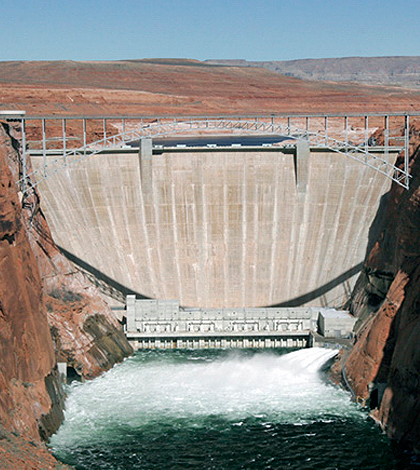
Glen Canyon Dam. (U.S. Bureau of Reclamation)
You’ve probably heard of the Four Corners region of the United States; that’s where the corners of Arizona, New Mexico, Utah and Colorado meet at one point. These same four states are also part of the Colorado River Storage Project (CRSP), which began to change the face of the American West in 1956, enabling the population explosions in places like Phoenix and Los Angeles to continue thanks to usable water.
Glen Canyon Dam is 220 meters high and 480 meters wide, and this massive structure has changed this section of the Colorado River all the way to Lake Mead dramatically. It has also increased low-flow magnitudes, decreased peak flow magnitudes and volumes and caused fluctuations in daily discharge levels that the area relies upon for generation of hydroelectric power.
Scott Vanderkooi, Supervisory Biologist and Chief of the U.S. Geological Survey (USGS) Grand Canyon Monitoring and Research Center, acknowledges the dynamism in the area:
“It’s a different river than it was before the dam, obviously. There are some invasive species in the mix, and the park service is concerned about it. They have a strategy for managing shoreline vegetation and that includes fostering and favoring native species.”
Meanwhile, the metropolitan Phoenix area has again topped the U.S. in population growth, with Las Vegas and suburbs of Los Angeles close behind. These aren’t new trends, and this kind of growth is only possible so long as the water is present. Therefore, the demands on the Colorado River have continued to intensify over the decades, and pressures on the ecosystem with them.
Supporting a Changing Ecosystem
Scientists discovered by 1974 that the alluvial sandbars of the downstream river were eroding, primarily because the fine sediment that had been replenished during annual floods in the past was now being trapped by the reservoir. Within the Grand Canyon, particularly near Marble Canyon at its upstream end, the dam has eliminated large amounts of fine sediment the upstream Colorado River once provided. The sandbars, which are usually found downstream from rapids in eddies, serve as flat ground for backwater habitat used by fish, both native and introduced, and also for camping grounds. They also support native vegetation and provide fresh sand to protective dune fields that cover significant archaeological sites.

A sandbar deposited by a controlled flood in the Grand Canyon. (Credit: Matt Kaplinski / Northern Arizona University)
These sandbars are critically important to many forms of life in and along the Colorado, so this was a warning sign for researchers. One thing that wasn’t in doubt was the importance of the area and the many competing interests relying upon the river. Vanderkooi explains the complex web of regulatory dynamics that control the region.
“The Colorado River and the Grand Canyon, it’s iconic landscape valued by many for many reasons. Management and policy can have a strong influence on what the ecosystem looks like, but the USGS is a science agency with no management responsibilities or regulatory authority. As a part of USGS and as science provider to the Glen Canyon Dam Adaptive Management Program, GCMRC’s role is to provide science support to the Dept. of Interior and its agencies that are responsible for managing the Colorado River, adjoining Federal lands in Glen and Grand Canyons, and the plants and animals that live there. These agencies include the Bureau of Reclamation, the National Park Service and the U.S. Fish and Wildlife Service. Decisions about the management of the Colorado River ecosystem in Glen and Grand Canyons are made by Interior and these agencies.”
One of the advantages scientists had in taking on this challenge was a longterm set of data to start with, in that they had a historical record of what the area looked like long before the dams were constructed. This allowed them to visualize how the sandbars formed before humans intervened.
Vanderkooi explains, “We have 140+ years of photographic records of these ecosystems, going all the way back to the old glass plate photos, so we can see what this river looked like even way back then and see what changes have occurred by making comparisons with more recent photos.”

Historical photo of sandbar in the Grand Canyon from 1872. (Credit: National Park Service)
The High Flow Experiments
The U.S. Department of the Interior (DOI) sought a solution to the problem of eroding sandbars in a controlled flooding strategy called the high flow experiments. Experiments rebuilding sandbars began in 1996 with controlled floods that bypassed hydroelectric facilities and released volumes of dam water about half the magnitude of natural spring floods from before the dam was built, lasting three to eight days. The scientists found that sandbars regained substantial mass during the flood’s first few days, and then eroded again over the next 6 to 12 months of normal dam operations. They found that the timing of controlled floods was important, and had to follow natural flash floods which brought high volumes of sand to the river itself.
In 2004 and 2008 after seasonal thunderstorms, the team worked to test this theory by releasing controlled floods. The thunderstorms caused large amounts of sand to be present in the river, so if the theory was right, the controlled floods immediately afterward would be more fruitful in the sand deposited in the sandbars. The strategy proved to be a good one, and starting in 2012 the DOI was ready to implement a longer term strategy.

Glen Canyon Dam open for high flow experiments. (Credit: U.S. Bureau of Reclamation)
Now, scientists continue to hone the high flow strategy and to verify that the project is working. Many sandbars have regained some size in the aftermath of every controlled high flow, and scientists working on the project have also noted specific recoveries to species in the ecosystem. While this might sound like a simple project, this is deceptive. There are actually many challenges inherent to the project, including: the need to track the influx of sand in the sections of the river; calculating sand storage in channels; modeling and predicting sand flux for high flows; scheduling controlled floods without disrupting hydroelectric power provision and water supply; and evaluating the results of every high flow before the next.
Vanderkooi describes part of the way the USGS team responds to these challenges: “We are monitoring sand in the Grand Canyon in real time using acoustic doppler current profilers. These instruments use sonar to measure the concentration of sand moving through the river, and to calculate sand mass balance. There are six segments of river parsed out, and we measure how much sand goes in and out of each 30-60 mile stretch.”
Both the scientific and management teams also use photographs and repeat topographic surveys to evaluate the results of the controlled floods and their effects on the sandbars. At 43 sites throughout the Grand Canyon, remote time-lapse cameras capture daily changes in sandbars so the teams can monitor the immediate changes from each controlled flood, and compile data to show longer term effects.
Vanderkooi elaborates, “We use multi-beam sonar systems to map the river channel in different reaches, and repeat it a couple of years later to determine where sand is accumulating and eroding.”
Successes for the High Flow Experiments
The sandbars are growing, and the ecosystems they support appear to be healing. One sign of this is the recovery of previously endangered species endemic to the area.
Vanderkooi describes the team’s work with the federally protected humpback chub fish: “The humpback chub is an endangered species in the area, one that is endemic to the Colorado River basin, and in fact is only found in the basin. There are six populations in the watershed, and the Grand Canyon population is the largest and healthiest. 10 to 15 years ago, populations were declining. Since then, we’ve seen population growth and apparent stability in recent years. We’ve also seen the range of humpback chub expanding inside the Grand Canyon. In the early 2000s, numbers were low, and the fish was hard to find. Currently, scientists are seeing a lot of young fish where they never used to find them. We’re seeing a lot of positive indications for this species.”

Humpback chub. (Credit: Arizona Game and Fish)
Monitoring and protecting this species has not been without its challenges, especially given the unique surroundings of the Grand Canyon and the competing demands of the project. Vanderkooi explains the process:
“We monitor fish populations by tagging, releasing and recapturing fish. Fish are marked with a type of tag called a passive integrated transponder that includes a microchip, each with a unique code. These are the same type of tag used by your vet when your pet gets microchipped. Each tag is the size of a long grain of rice and are inserted with a needle into fish so we can track them over time. We use the information collected by repeatedly capturing and recapturing humpback chub and other species to monitor movement and growth of individuals and determine overall survival rates, population trends and estimate abundance. These fish have a 40 year-old lifespan, potentially, and some tagged individuals have been at large for 20+ years. It’s hard to get your hands on fish in remote locations like the Colorado River in Grand Canyon, but we have employed remote antenna arrays and portable antennas, which make it easier to detect tagged fish.”
Preparing for an Uncertain Future
While this has certainly been a success to date, there is no guarantee that the sandbars will continue to rebuild. They erode between each high flow, making the long-term results of the entire protocol dependent upon seasonal precipitation, operational decisions about flooding releases from Lake Powell and other issues. Current climate change models cannot predict with any certainty how seasonal thunderstorm activity will transform sand accumulation in the river and its tributaries in the future. However, both years with high-snowpack and the need to transfer water storage to Lake Mead from Lake Powell could result in large clear water releases that cause even more sandbar erosion — just as they did between 1996 and 2000, and in 2011. Controlled floods are not likely to be enough to cope with the erosion under these conditions.

Jets of water rushing from the dam as part of a controlled flood. (Credit: U.S. Bureau of Reclamation)
Meanwhile, nearly all climate change projections include increases in temperature and decreases in runoff from the Colorado River. This is likely to increase sandbar size, but will also bring other changes to the ecosystem that the USGS team will need to cope with. The give and take between the scientific team and the management agencies is a productive system that can continue to serve the area, as Vanderkooi explains:
“Adaptive management uses scientific information and tests policies to manage limited resources to achieve many goals, and manage a complex ecosystem. There are a huge number of demands on this river, and resource managers try to balance them all. They use the best available science provided by USGS and other scientists to inform management and decision-making. I don’t know how else you would do it with the number of demands placed on this river.”
With so many competing demands, can scientists protect the area, even with the looming threat of climate change on the horizon? Vanderkooi is cautious, but ready for the challenges:
“Management is open to our input, and scientists interact with them and other stakeholders regularly. Management asks us for information on key resources and wants to know what are the status and trends we’re observing and look to the scientists to help reduce uncertainties. I’ve worked on many rivers and in systems without formal adaptive management programs. I believe this program has been a success so far, but it is a work in progress and is something that needs constant attention. It’s a dynamic system and a complex ecosystem in a changing climate. That’s going to need constant attention.”
Top image: Glen Canyon Dam. (U.S. Bureau of Reclamation)


0 comments