
California groundwater withdrawal stresses San Andreas Fault, grows Sierra Nevada
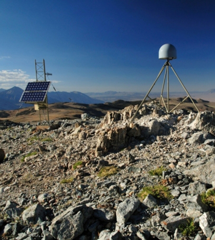
Modest vertical uplift of GPS stations in across Central California is attributed to human-caused groundwater depletion in the adjacent San Joaquin Valley. (Credit: UNAVCO)
Wracked by drought for the third consecutive year, California agriculturalists and water managers are increasingly tapping into the state’s diminishing groundwater supply to meet needs. But this activity is placing additional stress on the volatile San Andreas Fault and causing the nearby Sierra Nevada mountains to grow.
As California drains groundwater from the San Joaquin Valley aquifer, the floor of the entire Central Valley sinks. Known as sediment compaction or subsidence, this geological effect has been researched for decades. A new study, published in Nature, shows that this process is also responsible for other, potentially problematic phenomena.
Researchers from the University of Ottawa; University of California, Berkeley; Western Washington University and the University of Nevada, Reno, conducted the study using a series of models to understand what groundwater loss might have on the vertical motion of the Earth’s crust. The scientists confirmed their suspicions: pumping groundwater from the Central Valley is causing the region’s floor to rise and fall.
A statewide network of GPS stations, capable of tracking vertical movement down to the millimeter, provided data for the study’s models. The University NAVSTAR Consortium installed the stations to monitor seismic activity at the San Andreas Fault.
“We observed that around the Central Valley of California, the GPS stations show an uplift of about one to three millimeters per year,” said Pascal Audet, professor of geophysics at the University of Ottawa. “We noticed that this also coincides with the region where groundwater is being pumped for irrigation.”
“The fact that human activity can actually produce motions of the Earth’s crust is something that is quite an eye opener,” Audet said. “We were quite surprised that such a continuous effect could be seen in the rock record.”

The approximate location of maximum subsidence in the United States the site in the San Joaquin Valley. Showing approximate altitude of land surface in 1925, 1955, and 1977.
The elastic response of the Earth’s crust explains the growth of the Sierra Nevada. The vast volume of water stored in the San Joaquin aquifer weighs heavily on the crust, forcing it downward. As that water is pumped out of the ground, it lessens the load on the crust, allowing it to rise again. Winter rains reverse the process to some degree, leading to further fluctuations.
Over the past century and a half, the Sierra Nevada has grown by about a half foot, while the same activity has caused the Central Valley floor to sink several meters over only a few decades.
More pumping near the fault could lead to greater seasonal fluctuations, raising the risk of small earthquakes in the area. In seismically sensitive areas, even a small quake could act as a catalyst for a much larger, more destructive event.
“It’s obvious that if we take more groundwater out it’s going to have a major effect on the San Andreas Fault,” Audet said. But the study’s implications reach far beyond California. Audet said that “any sort of resource extraction could produce similar effects.”
In addition to further monitoring of the Central Valley region, Audet said that the next step for the researchers might involve observing the phenomenon in other parts of the world, such as northern India where huge agricultural operations could exhibit similar groundwater use characteristics.
“It’s hard to tell what effect this is going to have,” Audet said of the study’s findings. “It certainly adds to a long list of things that policy makers need to take into consideration… especially in periods of drought where there’s a lot more stress on the aquifer.”
Image: Modest vertical uplift of GPS stations in across Central California is attributed to human-caused groundwater depletion in the adjacent San Joaquin Valley. (Credit: UNAVCO)


0 comments