
Colorado State Researchers Estimate Snowpack, Plumb New Depths With Soil Study
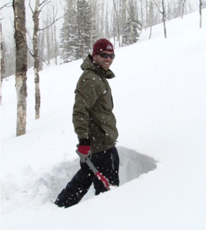
Ryan Webb digs a snow pit at a research site in northwestern Colorado. (Credit: Niah Venable)
One of the most critical snowpacks in the U.S. is in the Sierra Nevada mountain range. Supplying much-needed freshwater to California, Nevada and Arizona through its melting, the snowpack is a critical source of water for thousands of people who live in the drought-stricken desert mountain region.
But how much water the Sierra Nevadas snowpack can provide is difficult to estimate using traditional one-dimensional models and given how the water levels are becoming lower every year, good estimations are becoming more and more critical. Thanks to Ryan Webb, a doctoral student at Colorado State University, and the professors and students he works with, using inaccurate one-dimensional models to estimate water provided by the snowpack will hopefully become a thing of the past.
The multi-dimensional model Webb is working toward will account for variables not currently incorporated in most one-dimensional models that assume homogenous terrain: drying and wetting behavior of the soil underneath the snowpack; behavior at different elevations; different slope types; and different tree cover types including open, drip edge and canopy. In general, the overarching question his research seeks to answer is how climate change has affected, and will continue to affect, water supplies.
To improve knowledge of the fate of snowpack water, Webb used 97 moisture sensors buried at various depths at various elevations in the Sierra Nevadas. The soil measurements are taken directly underneath the snowpack. These measurements provide snow depth.

Colorado State University’s snow lab group takes measurements in Colorado. (Credit: Ryan Webb)
“Melting snow can produce highly variable results in the top meter of soil,” Webb notes. “A one-dimensional model assumes uniform melting over an area…That might work in a largely homogenous landscape like Canadian tundra, but in a diverse terrain like the Sierra Nevadas, the melting is anything but uniform.”
The unique feature of the analysis Webb and his team are doing is that they are making their observations using sensors deep beneath the snowpack. Webb points out that the area of interest in their research is broadly called the “critical zone,” which refers to the area from the very tops of the trees down to the bottom of the groundwater, a permeable near-surface layer of the Earth.
Viewed as a living, breathing and evolving boundary layer where soil, water, air and living organisms interact, the critical zone determines the quality and availability of life-sustaining resources. The critical zone determines food production and water quality, among other important features. Many Critical Zone Observatories exist across the U.S., and Webb’s work is specifically affiliated with the Southern Sierra Critical Zone Observatory in Colorado.
Webb’s 97 sensors provide volumetric water content in cubic centimeters of water. They provide the net weight of snow, or snow’s water equivalent. In addition, Judd sonic depth sensors shoot radar straight down to assess depth. These are located above the soil sensors. Some of the data are gathered in real time. Other data used in the study are gathered via weather stations which provide precipitation, temperature and wind information.
Webb explains that sensors are now less expensive so it was possible to use many more than in previous work. “There have been small advances in technology; we are always hoping for sensors that are tougher than the previous ones,” said Webb. “Currently they last about five to 10 years and sometimes longer, but it’s somewhat climate dependent. For example, Antarctic sensors probably would not last that long.”

Staff with the Southern Sierra Critical Zone Observatory maintain equipment and instruments in the Southern Sierra Nevada Mountains. (Credit: Erin Stacy)
Webb says soil depth influences the whole groundwater recharge process he is trying to investigate. Groundwater recharge is the process by which surface water travels downward to the groundwater. Modeling snow melt at different depths to accurately represent groundwater recharge behavior is complex. Webb says multiple melt events must be considered and that there can be great variation from day to day. “Most melt events only have an effect at a shallow depth,” Webb explains.
Webb is also working on incorporating the influence of slope into the snowpack groundwater recharge model. North-facing slopes hold onto snowpack longer, while South-facing slopes tend to be warmer and cause faster melt. Another factor Webb is working to incorporate is tree cover: With no tree cover, the snowpack will be deeper. On the drip edge, or edge of a tree canopy, a mixture of open and canopy cover snowpack can occur, while the snowpack under the tree canopy tends to be shallower since the canopy interrupts snowfall and the trees themselves will drip snow, also influencing snowpack below, Webb observes.
Webb is currently working on a two-dimensional model with more dimensions to hopefully follow. He is interested in the horizontal movement of water and hopes to model it using a lot of new data that have been gathered.
Webb was surprised that his research did not turn out to be more black and white. “Everything was very variable and there were lots of complex variables which interplayed,” said Webb. “I thought it would be complicated to express in a model, but it’s even more complex than I anticipated.”
Preliminary tests of the two-dimensional model showed that it may work better than a one-dimensional model, Webb says. He plans on continuing his research in the near future, tinkering with both conceptual and analytical models of snowpack melt and groundwater recharge processes.
Webb credits Roger Bales of the University of California as a central figure in helping his work within the Critical Zone Observatory.
“I especially want to thank the people at the CZO. They have been fantastic,” said Webb. “I wouldn’t have been able to do any of this work without their support.”
Top image: Ryan Webb digs a snow pit at a research site in northwestern Colorado. (Credit: Niah Venable)


0 comments