
Lake Superior Weather Buoy Provides Valuable New Data
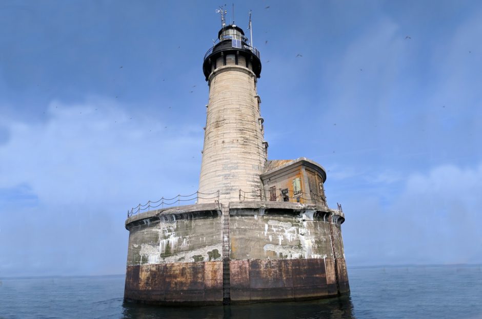
The Stannard Rock Lighthouse in a remote part of Lake Superior is outfitted with a meteorological station. (Credit: John Lenters)
A new weather buoy in a remote part of Lake Superior is providing much-needed weather data to local mariners, the National Weather Service and researchers.
Scientists from the Superior Watershed Partnership (SWP), Lentic Environmental Services (LES) and the University of Colorado-Boulder recently deployed the buoy on the lake one mile north of Stannard Rock Lighthouse. SWP gained ownership of the lighthouse in 2015.
Because the light was built on a large reef in a remote part of the lake, it is one of the most popular trout fishing and charter boat destinations on the Great Lakes. It has also been the location of a NOAA weather station since 1984 and a Great Lakes Evaporation Network monitoring site since 2008. The lighthouse equipment includes a Campbell Scientific meteorological station and eddy covariance tower, which measures lake evaporation and surface heat fluxes.
Over the years, the weather data collected at Stannard Rock has also been very useful for recreational boaters who wish to make an informed decision when planning a fishing trip to the site. But the weather stations at the lighthouse are not able to provide any direct observations of wave conditions, and there are also weather differences due to the height of the instruments, which are roughly 114 feet above the lake’s surface.
“There is a lot of recreational boating traffic traveling offshore to a very vulnerable location for marine hazards in Lake Superior, like high winds and waves,” said Matthew Zika, the Warning Coordination Meteorologist from the National Weather Service office in Marquette, Michigan. Zika also noted that the weather monitoring station at the top of the lighthouse is not always representative of what is occurring on the lake surface.
In 2017, SWP and CU-Boulder received funding from the Great Lakes Observing System (GLOS) to upgrade a weather buoy previously used on a lake in Alaska for the Stannard Rock area, in order to get more accurate surface weather and wave data. In August, Dr. John Lenters and a small team deployed the Nexsens CB-150 buoy in the water near the lighthouse. Lenters is a climate scientist and limnologist from Lentic Environmental Services who works as an independent contractor with the Superior Water Partnership and Northern Michigan University (NMU).

Superior Watershed Partnership’s new Stannard Rock CB-150 weather buoy floats in Lake Superior. (Credit: John Lenters)
The buoy is equipped with an Airmar weather sensor, Seaview wave sensor and Nexsens water temperature sensor and is collecting data on surface water and air temperature, as well as wind speed and direction, and wave height and wave frequency. The data are transmitted by satellite and posted in near real-time to the GLOS and National Data Buoy Center websites for the public to access.
“This is the first time that wave height and surface weather observations have been available from this area of the lake,” said Lenters.
The new buoy is one of three buoys deployed on Lake Superior this year by NMU and SWP. The other two are also owned and maintained by NMU, an occasional partner and collaborator with SWP. The original buoys have been widely used by local recreational boaters and businesses in Marquette and Munising, and Lenters is hoping for the same response with the Stannard Rock buoy.
“The hope is for the buoy to continue to receive financial support through grants and community funding,” said Lenters.
If interesting weather observations are any indication, the Stannard Rock buoy is probably here to stay. Although it has only been in the water a short time, the data are already proving helpful.
“One of the things we’ve been seeing is that the timing of current wave forecasts have occasionally been off by close to six hours when compared with the buoy data,” said Lenters. “High wave events are often coming in sooner than the National Weather Service models predict.” Lenters also noted that the buoy survived a recent high-wave event, when 10-11 foot waves were observed at Stannard Rock on October 15.
The National Weather Service uses atmospheric models to predict weather and couples these with wave models on the ocean and Great Lakes to predict wave height. The model verification data comes from several weather monitoring stations, as well as upper air and satellite observations. The new Stannard Rock buoy is now a part of this network.
“While the buoy has only been deployed for a short time, the data from it has proved to be very valuable in our operations,” said Zika. “Having a wave monitoring data point near Stannard Rock plays an important role in our marine hazard decision making, messaging and briefings to marine interests traversing Lake Superior.”
The buoy also has the potential to impact the weather models in the future.
“While it is still early, the data from the Stannard Rock buoy will be used as a validation/verification point against the wave model within the Great Lakes,” said Zika. “If any biases are apparent, it will allow for adjustments in the model to create more accurate forecasts.”
Top image: The Stannard Rock Lighthouse in a remote part of Lake Superior is outfitted with a meteorological station. (Credit: John Lenters)
2 Comments
Leave a Reply


Pingback: Lake Superior Weather Buoy Provides Valuable New Data - Lake Scientist
Pingback: Superior Watershed Partnership Adds SeaView Wave Sensing Capability to Lake Superior – Seaview Systems