
Landsat 8 satellite begins monitoring
NASA has transferred operational control of the Landsat 8 satellite to the U.S. Geological Survey, according to a release. The satellite was launched Feb. 11.
After launch, NASA engineers have been working with the USGS to put the satellite through a series of tests to ensure operational readiness. Some of those include steering the craft into orbit, calibrating its detectors and collecting test images.
Landsat 8 continues the Landsat Data Continuity Mission, a 40-year NASA effort that has helped scientists learn more about the Earth from space. The satellite began collecting 400 scenes a day on May 30. The images will be processed and archived at the USGS Earth Resources Observation and Science Center in Sioux Falls, S.D.
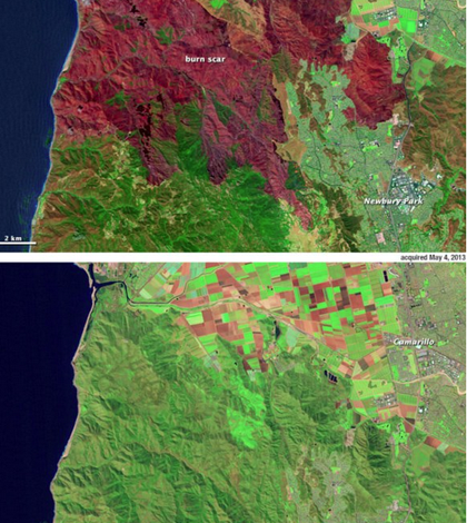
Image: A before-and-after image series of a burn scar in southern California captured by Landsat 8 (Credit: USGS)


0 comments