
Landsat data show global forest losses and gains
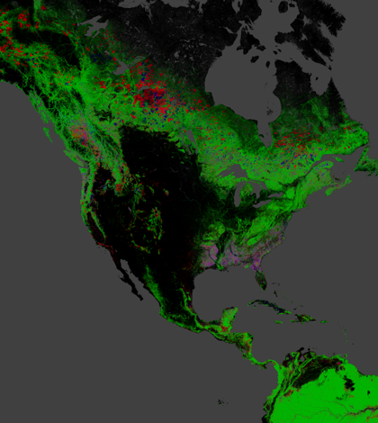
Red indicates forest loss, blue is gain, and green is forest extent(Credit: Nasa/University of Maryland)
Researchers at the University of Maryland led a study using data from NASA’s Landsat satellite to evaluate global forest losses and gains, according to a release. They say that Landsat images provide a good standardized method of judging forest coverage.
The researchers looked at a period from 2000 to 2012, analyzing 654,000 images to compile forest maps. They found that 888,000 square miles of forest were lost, while 309,000 square miles regrew.
NASA officials say the study marks the first time a global analysis of forests has been possible. They note that synthesizing findings is easier because Landsat takes the same quality images throughout its polar orbit.
Image: Red indicates forest loss, blue is gain, and green is forest extent (Credit: Nasa/University of Maryland)


0 comments