
More Accurate Rio Grande Flow Forecasts May Help Water Allocations In West
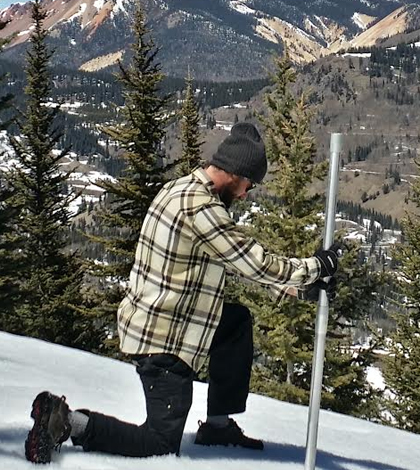
John Mickey, a field technician, takes a snowpack measurement. (Credit: National Center for Atmospheric Research)
An agreement between the states of Colorado and New Mexico requires that Colorado deliver a certain amount of water from the Rio Grande River each year. The amount is based on the river’s total annual flow, which means that water managers don’t know exactly how much should be delivered until the end of every year. The amount of water given to New Mexico throughout the year, then, is based on forecasts of what the year-end’s total flow might be. And making sure those forecasts are reliable is more easily said than done.
Scientists at the National Center for Atmospheric Research are working to make the flow predictions better. Their work is relying on instruments to monitor snow depth, streamflows and meteorological conditions and is being completed alongside scientists from NASA’s Jet Propulsion Laboratory who are doing airborne surveys of the river’s basin to collect LIDAR measurements. Polarimetric radar deployed at the Alamosa airport by a group from the National Severe Storms Laboratory is also providing precipitation measurements for the project. Water managers from the Conejos Water Conservancy District are also assisting in the project, which is sponsored by the State of Colorado Water Conservations Board.
If the work is successful, a more accurate way to forecast water availability for states relying on water from the Rio Grande River is possible. That could benefit scientists who use the data for research; farmers who rely on them for ensuring good crop yields; and water managers who oversee reservoirs to allocate water for irrigation and other purposes.
“Errors in those forecasts create difficulties for water managers,” said David Gochis, scientist at the National Center for Atmospheric Research. “In the past, errors in the forecasts have equated to millions of dollars in terms of the open water market value of water.”
The work to make the forecasts better is in its beginning stages, as Gochis and others are just now wrapping up observational work. In addition to the remotely collected snowpack and precipitation measurements contributed by NASA and the Severe Storms Lab, they collected data at monitoring sites along the Conejos River, a major tributary to the Rio Grande River.

An automated hydrometeorological station that measures snow depth, wind, temperature, humidity, solar radiation, soil moisture and precipitation. (Credit: David Gochis)
Equipment deployed along the Conejos River includes six snow-monitoring stations and five streamflow gauges. The waterway had previously lacked any such comprehensive equipment.
“My group is using some basic snow depth, meteorological and streamflow measurement instruments to attempt to provide a better understanding of environmental conditions in the region that influence the timing and amount of snowmelt and the amount of water lost to the atmosphere,” said Gochis.
Scientists are working to develop a modeling system that incorporates new information on physical processes and a higher spatial resolution to better predict the timing and amount of snowmelt. They are using a data assimilation process that involves continually adjusting the model to agree with their observations of snowpack and streamflow.
“While we don’t know what the future weather will bring exactly, having an improved estimate of snowpack conditions can significantly improve water supply forecasts, particularly later in the springtime and early summer,” said Gochis.
The NCAR model will be called WRF-Hydro (Weather Research and Forecasting Model – Hydrologic extension). After it’s been run through its paces, scientists plan to scale it up for forecasting applications nationwide. It’s been chosen by the National Oceanic and Atmospheric Administration’s National Water Center for deployment across the country in 2016.
“In a sense, the project in Upper Rio Grande basin is somewhat of a prototype for the national effort,” said Gochis. “While it’s clear that many regions of the nation do not rely on snowpack for modeling, the same kind of data assimilation and high-resolution modeling approaches can be extended to provide new water forecast information where no current forecast information exists.”
Top image: John Mickey, a field technician, takes a snowpack measurement. (Credit: National Center for Atmospheric Research)


0 comments