
Muskingum Watershed Conservancy District minds flood control and conservation
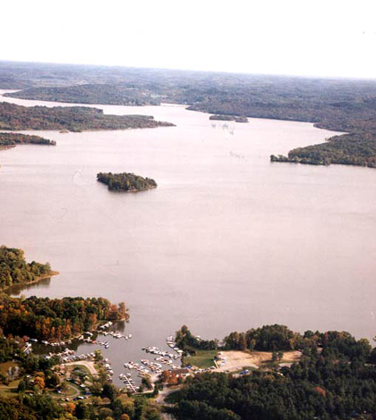
An aerial photo of Seneca Lake, a flood control project (Credit: Muskingum Watershed Conservancy District)
In the Great Flood of 1913, which killed 500 Ohioans and caused $300 million in damage, every river in Ohio spilled over its banks. Among those flooding rivers was the Muskingum, a major tributary to the Ohio River with a watershed that covers 20 percent of the state and more than 8,000 square miles.
The state of Ohio’s response to the disaster was the Conservancy Act, which allowed for the creation of regional flood control agencies. The Muskingum Watershed Conservancy District was formed in 1933 and continues to pursue its mission of reducing flooding and promoting conservation in the region’s waterways.
The district works closely with the U.S. Army Corps of Engineers, which owns and operates 16 dams along the Muskingum River. Twelve of those have reservoirs with permanent pools of water.
“The reservoirs were built following the Dust Bowl and the droughts that occurred in the ‘20s,” said Darrin Lautenschleger, the conservancy district’s public affairs administrator.
The reservoirs protect the areas against flooding while also making sure they retain enough water to support their residents’ needs and give them recreational opportunities. Monitoring water quality in the reservoirs is central to reaching those larger goals.
“The biggest issue is sedimentation,” said Mark Swiger, conservation administrator. “Now that HABs (harmful algal blooms) are such a concern, we’re also looking at nutrients with the Ohio Lake Management Society testing in nine reservoirs this year.”
So far, Swiger says no toxins have been found that would cause concern. Algae can be found in the district’s lakes, of course, but they haven’t caused a problem.

The dam at Piedmont Lake, one of the district’s flood control projects (Credit: Muskingum Watershed Conservancy District)
YSI multimeters are one of the most common instruments the district uses. Volunteers or conservancy staff use the meters to test for dissolved oxygen, temperature, pH, conductivity and other indicators of water health. The Corps provides equipment and training, while the district provides personnel to monitor. All data are maintained in an Army Corps database which is shared with the public on request.
The working relationship has been key since the mid ‘80s, when the Corps was short of personnel to continue monitoring. Swiger says the district started helping in 1986, and the benefits of the partnership have been obvious. Since the system of dams and reservoirs were constructed in 1939, the Army Corps estimates around $10.7 billion in property damage from flooding has been prevented. Maintained water quality has been equally vital for those residing in the watershed.
With aging dams, there are plans in place for upgrades, to the tune of $680 million. Lautenschleger says the money, which mostly comes through the federal budget, will first be applied to urgent safety and maintenance concerns.
The district has a similarly cautious approach for oil and gas drillers in the watershed. With all of its acreage within the extent of the Utica Shale natural gas formation, it has granted oil and gas leases to some drillers. Lease proceeds are used to upgrade facilities and enhance programming, among other things. Lautenschleger says the profits are already benefiting the public.
“It’s just like any other industrial site,” said Swiger. “You have to monitor and be aware of what’s happening there.”


0 comments