
NASA’s new satellite-bound tool gets trial run over ephemeral Arctic melt ponds
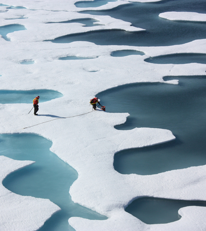
Melt ponds form when water pools on ice sheets. They absorb more heat than the surrounding ice. (Credit: NASA/Kathryn Hansen)
A NASA observational aircraft will fly over Alaska and the Arctic Ocean this summer to test instrumentation that will be implemented in a 2017 satellite mission, according to a release from the agency.
The Multiple Altimeter Beam Experimental Lidar, or MABEL, will use pulses of green laser light to measure elevation and snow and ice coverage. Data gathered from this instrument will help NASA scientists to develop algorithms for use with the Ice, Cloud and land Elevation Satellite-2, which will take orbit in 2017.
Melt ponds are a primary focus for the research campaign, as scientists know relatively little about the ephemeral water bodies. Some research suggests that melt ponds can provide insight into properties sea ice, and forecast end of summer ice coverage.
Image: Melt ponds form when water pools on ice sheets. They absorb more heat than the surrounding ice. (Credit: NASA/Kathryn Hansen)


0 comments