
New Ocean Surface Current Data Available From PacIOOS
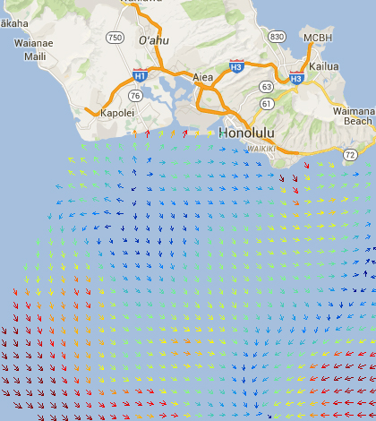
The Pacific Islands Ocean Observing System's Voyager tool now covers ocean surface currents. (Courtesy PacIOOS)
A new data set has been added to the Pacific Islands Ocean Observing System’s Voyager online tool, according to a release from the University of Hawaii at Manoa. The new information covers ocean surface currents near Hilo, Hawaii, and complements wave buoys deployed off the coast there.
The surface current data can be used in modeling, forecasting and water quality monitoring, but can also be helpful in disaster response. That’s because real-time surface current data are incredibly valuable during events like oil spills or search-and-rescue operations.
Professors at the University of Hawaii at Hilo who work with the PacIOOS say that the new data will help ocean managers and researchers. They also plan to integrate the data, made available through an academic project, into educational courses in the marine science curriculum.
Top image: The Pacific Islands Ocean Observing System’s Voyager tool now covers ocean surface currents. (Courtesy PacIOOS)


0 comments