
Online Mapper Shows Groundwater Quality By Decade
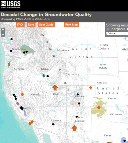
Screenshot of the mapping tool. (Credit: USGS)
An online mapper, which is one aspect of the National Water-Quality Assessment’s efforts, provides a look at changing groundwater quality across the United States on decadal time scales, according to a release from the U.S. Geological Survey (USGS). The agency has logged the changes over many years and is making some of their finds available in the mapping tool.
The mapper shows how concentrations of 24 contaminants, such as nutrients, pesticides, metals and volatile organic compounds, are changing over decadal periods in 67 groundwater networks across the Nation. Each network consists of about 20 to 30 wells selected to represent water-quality conditions in a given geographical area, aquifer and in some cases a specific land use.
Groundwater quality data were collected in about 5,000 wells between 1988 and 2001 by scientists with the USGS. About 1,500 of those wells were sampled again between 2002 and 2012 to evaluate the decadal changes in groundwater.
Top image: Screenshot of the mapping tool. (Credit: USGS)


0 comments