
Planned Feather River Observatory To Gather Data, Aid Hydroelectric Operations
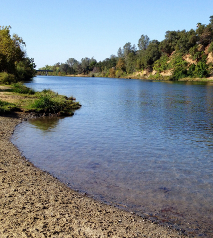
Feather River in California. (Credit: Ray Bouknight via Creative Commons 2.0)
The Feather River in California is a main tributary of the Sacramento River. Fed by Lake Oroville to its north, the river runs for about 71 miles and is a large part of California’s State Water Project, a hydroelectric effort producing power for the state’s residents.
The company that is charged with tapping the Feather River’s hydroelectric potential is PG&E. It owns several dams along the river and is concerned with its flow, among other things.
Recently, PG&E has teamed up with scientists at the University of California, Berkeley, to model the Feather River’s hydrology in an effort to improve the operations of its hydroelectric dams along the waterway.
“The Feather River Hydrologic Observatory is to be able to actually improve on the cost of the inefficiencies of operating hydroelectric dams,” said Steven Glaser, a professor of civil and environmental engineering at the university.
Glaser is part of a group at the university and PG&E working to better model the changing conditions of the Feather River. In the past, he has worked on the American River Hydrologic Observatory, a very large network of wireless sensors built to help meet the needs of the National Science Foundation-funded Southern Sierra Critical Zone Observatory.
On the educational side, Glaser says that one of his students will gain experience with modeling through a position at one of PG&E’s laboratories. PG&E will of course benefit from advanced data on its hydroelectric operations and more precise models that can help the company weed out inefficient practices.
The effort, which is still in the beginning stages, will build on some of the work that Glaser has done at the American River alongside collaborators Roger Bales and Martha Conklin, both founding professors of engineering at UC Merced.

The Feather River flows through a valley near Feather Falls, California. (Credit: Justin Rocha via Creative Commons 2.0)
“It’s a three-year project. In the first year, we’ll set out the instruments and get working on the modeling. It’s a big project,” said Glaser. “Some people will be working on the data coming in, synthesizing it, and that will actually go into the models that PG&E uses.” The data will be plugged into the U.S. Geological Survey’s Precipitation Runoff Modeling System, he says.
Getting the project underway includes using much of the same wireless sensing technology deployed at the American River Hydrologic Observatory. Nodes in the network will be built by Metronome Systems, a company that Glaser helped found, which manufactures low-power wireless computing and sensing devices that deploy quickly to form large-scale networks.
“It’s the same hardware. It’s a wireless sensor network. You can use the nodes as data loggers, but it’s totally wireless. We’ll put the nodes out into the field and with new sensors, it populates on its own,” said Glaser. “Each wireless node is also a logger and is very low-power. So they could run off D-Cell batteries. On each device, you can put 40 different sensors. It’s just drag-and-drop. Just install the drivers, there’s no amplification or filters. It’s all built in.”
The wireless sensor network to be deployed around the Feather River will incorporate sensors for measuring air temperature, humidity, solar radiation, soil moisture and snow depth. The measurements may help answer some lingering questions about the river and its hydrology, Glaser says.
“It (the Feather River) is much more rain-dominated than the American River. We hope to see the effects of climate change on rain and snow. PG&E folks say that there are tremendous effects of climate change and they want to be able to prove it,” said Glaser. “There are also a lot of orographic effects (from the mountains) there with the winds kicking up.”
The observatory will yield useful data for researchers, PG&E and the State of California. But Glaser says it could also provide a nice blueprint for other areas of the world dealing with water issues like California has in recent drought-dominated times.
“California is a good test site for the world because it has a lot of different land styles. We’ve started to work with people in Chile and their situation is similar with the Sierras,” said Glaser. “We’re talking with people in eastern France behind them. Certainly in China and India, where they have high mountain slopes and melting snow.”
Top image: Feather River in California. (Credit: Ray Bouknight via Creative Commons 2.0)


0 comments