
Salem Harbor’s murky water mystery prompts monitoring buoy network
When the scientists and advocates who keep an eye on Salem Harbor on the Massachusetts coast noticed that the embayment’s waters were prone to sporadic bouts of high turbidity, they found that the causes were just as murky as the water.
“The question came up, ‘Why are we getting these intermittent turbidity pulses?’” said Brad Hubeny, associate professor of geological sciences at Salem State University. “And if we can figure out why, is there a way to remedy the situation and make the water a little bit less murky?”
With support from the state, Hubeny and colleagues from Salem Sound Coastwatch have launched a network of water quality monitoring buoys to try and find an answer.
One of the drivers behind the research is the decline of eelgrass in the harbor. Eelgrass, an aquatic plant rooted to the seabed, serves as an important nursery habitat for juvenile marine life. Eelgrass populations are dwindling throughout Massachusetts coastal waters, Hubeny said, and Salem Harbor has been one of the hardest hit.
“We don’t know for sure that it’s turbidity that’s causing the eelgrass to decline, but it certainly is a stressor for these ecosystems,” Hubeny said. “They’re rooted to the bottom and they have to photosynthesize. If you reduce the amount of sunlight that’s getting to them, that’s going to stress them.”
Hubeny said the project is based on four working hypotheses that could explain the occasional murkiness:
- An increase in precipitation and runoff from the watershed is bringing more material into the harbor
- The boats moored in the harbor are stirring up sediment during wind events.
- Tidal currents are resuspending sediment
- An increase in nutrients into the harbor is feeding phytoplankton blooms
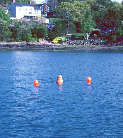
To test these hypotheses, Hubeny set up a network of five monitoring buoys equipped with water quality sensors. Two buoys sit near the mouths of tributary streams, with another two within boat mooring fields. A fifth buoy at the mouth of the harbor serves as a control site.
")
A monitoring buoy after spending some time Salem Harbor (Credit: Brad Hubeny)
Each buoy carries a Eureka Manta2 multiprobe measuring turbidity, conductivity and surface water temperature. Besides the obvious utility of turbidity data, the researchers are especially interested in conductivity, Hubeny said. That parameter gives an indication of salinity, which could be an important variable in determining whether the turbidity spikes are related to runoff.
“If it’s a runoff signal, we would expect to see a decrease in salinity with freshwater coming into the system that would also correspond to a rain event,” Hubeny said.
Several buoys also sport HOBO pressure transducers to measure water depth. That will help determine if turbidity levels fluctuate in a pattern that matches up with changing tides. Bottom water temperatures measured by HOBO temperature loggers attached to four of the buoys’ anchors will give researchers a handle on whether the water column is stratified.
Sediment traps also hang less than a meter below each buoy. Samples collected from the traps every month or so will be analyzed with an isotope ratio mass spectrometer.
“By measuring the isotopic composition of the organic matter in there, that’s giving us a handle on where that’s coming from, be it from land or from phytoplankton or from the bottom sediments,” Hubeny said.
The buoys have been in the water for less than a year and will remain there until December 2014. Even with plenty of data collection yet to go, the project has started to reveal some insights into the system’s functioning.
For example, turbidity levels have jumped during a few weather events, though it isn’t yet obvious if that’s a result of rain-driven runoff or wind-driven resuspension. Preliminary data also show events in which salinity drops and turbidity increases around the time of a rain event, suggesting suspended material is washing off of the watershed and into the harbor though its tributaries.
A full dataset could help make these processes–and ultimately, the water in Salem Harbor–more clear. Meanwhile, plenty of questions remain.
“We’re still working,” Hubeny said. “I think we’ve answered some, and then we’ve opened up new ones.”
Top image: A monitoring buoy deployed in Salem Harbor, Mass. (Credit: Brad Hubeny)


0 comments