
Texas Playa Lakes Help Recharge Ogallala Aquifer
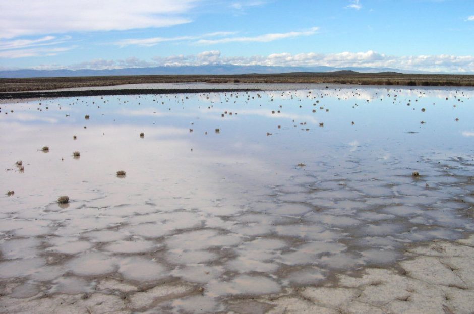
Playa lake in southwest Idaho, Jan. 29, 2011. (Credit: Wikimedia Commons User ThayneT via Creative Commons 3.0)
Managing groundwater is important everywhere, but especially so for the state of Texas that sustains periodic droughts. In the state’s panhandle, where farmers depend on Ogallala Aquifer recharge to irrigate their crops, it is probably even more so.
Monitoring the aquifer’s recharge in this area would be similar in approach to other efforts that study groundwater infiltration if it weren’t for all the playa lakes that dot the panhandle. In fact, there are more than 19,000 shallow, ephemeral lakes that dot the Texas High Plains, making the region home to the highest density of playa lakes in North America.
“Playas are real simple, closed hydrological systems. Water flows in after exceptionally heavy rainfall and ponds once the soil moisture deficits are filled. After that, the water either evaporates or infiltrates more deeply into the soil, eventually contributing to groundwater recharge,” said Andrew Weinberg, hydrogeologist with the Texas Water Development Board, who has been involved in a study of the lakes since 2011. “Playas are an important source of recharge to the Ogallala Aquifer, so a better understanding of the infiltration mechanisms is important for the agricultural economy of the region, which depends on the Ogallala as a source for irrigation.”
The year 2011 marked the worst one-year drought on record for the state, causing the lakes to incur a major moisture deficit. It might not have been good for farmers, but the bone-dry conditions were an ideal place to start investigating changes that the playa lakes see over time.
From that year through 2016, Weinberg and others with the water development board monitored 37 playa lakes across the panhandle. Pressure transducers allowed them to track changing water levels. Soil moisture sensors helped them to log groundwater infiltration. Data from solar radiation sensors and multi-parameter weather sensors clued them in on evaporation changes.

A mesonet site under construction. This site is intended primarily for rainfall and soil moisture monitoring. (Credit: Andrew Weinberg / Texas Water Development Board)
“The data from the WXT (Vaisala WXT520), plus readings for solar radiation and tipping bucket precip data are used to assess the water balance for a group of playa lakes we have been monitoring for the last five years,” said Weinberg. “All of the parameters … except for rainfall, and solar radiation from a pyranometer, are used in the Penman-Montieth equation. And the rainfall data is also important for the overall water balance.”
Researchers have used the equation to approximate net evapotranspiration for the lakes over the study period. The difference between that and the measured water level changes is taken to represent infiltration into the aquifer. From there, investigators sought to check estimates of infiltration against measurements of soil moisture change.
“We have the stations networked using cell modems. The data are aggregated into hourly and daily time steps and run through calculation spreadsheets to get hourly and daily evaporation,” said Weinberg. “We are collaborating with a group at the Lubbock Agricultural Research Service doing similar work.”
Playa infiltration rates varied widely over the study period, but investigators pinpointed that the lakes overall averaged 6.4 millimeters per day. The max rate that they saw across all playa lakes was 39 millimeters per day, while the minimum was just 1 millimeter.
Generally, Weinberg and others saw that infiltration rates followed the geographic distribution of soil types. They were higher to the south and west where soils are sandier. For any single playa lake, the rate varied largely due to prior wetting history and flood depth.
As for how much the playa lakes contribute to the Ogallala Aquifer each year, scientists found that it matches up well with previous estimates. On an individual basis, each lake adds about 25 centimeters of infiltration on average. When applied across the whole southern High Plains, that amounts to about 0.5 centimeters every year added to the aquifer.
Plans now are to roll some of the same gear used in the study into a network of weather stations that can help landowners. “We’re now shifting the equipment to other locations as part of a mesonet weather monitoring system we are developing,” said Weinberg.
Top image: Playa lake in southwest Idaho, Jan. 29, 2011. (Credit: Wikimedia Commons User ThayneT via Creative Commons 3.0)


0 comments