
Side-scan sonar: Tritech’s StarFish line is versatile
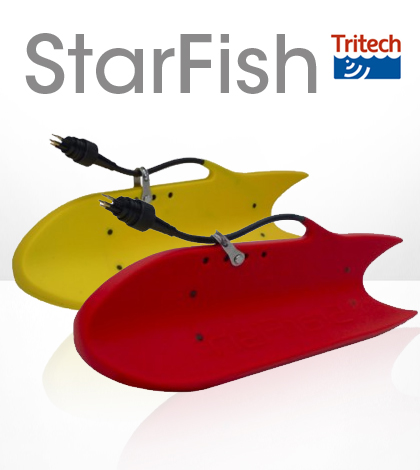
The Tritech StarFish line of side-scan sonar seabed imaging tools has a variety of applications, from searching for shipwrecks to analyzing underwater topography.
The trick is making sure you have the model that’s right for your uses.
We asked Suzanne Menzies, Tritech’s marketing coordinator, to explain some of the technology behind two species of StarFish, the 425F and the 990F. She kindly obliged, all the way from Tritech’s headquarters in Scotland.
Environmental Monitor: Technically speaking, how does the StarFish work?
Suzanne Menzies: By transmitting a narrow, fan-shaped acoustic pulse perpendicular to its direction of travel, the side-scan sonar sends acoustic pulses outwards. The seabed and other objects reflect some of the sound energy back in the direction of the sonar, known as backscatter, and the travel time of the returned pulse is recorded together with its intensity. As sounds travels at a known velocity of approximately 1,500 meters per second, we can directly relate the time we received an echo to the range of the target that reflected it.
This scan-line of information is sent to a topside computer for interpretation and display, and by stitching together data from successive pulses, a long continuous image of the seafloor is created, as the sonar is towed from the survey vessel.
EM: Can you explain Compressed High Intensity Radar Pulse?
SM: StarFish systems are an ideal tool for shallow water surveys through the application of Compressed High Intensity Radar Pulse (CHIRP) and digital-signal processing (DSP) techniques.
Instead of using a single frequency pulse, the frequency within the pulse is changed throughout the duration of transmission, from one frequency to another. For example, at the start of the transmission the sonar may operate at 425 kHz and at the end, it may have reached 475 kHz.
The difference between the starting and ending frequency is known as the bandwidth of the transmission and typically the center frequency of the transmission is used to identify the sonar.
By constantly changing its frequency over time, this chirped transmission can be thought of as having a unique acoustic signature.
EM: What drives the sonar wave pulses?
SM: The StarFish has two transducers, transmitter and receiver elements, mounted in the lower fins. These transducers are angled 30 degrees down from the horizontal and acoustically transmit sound in a ‘fan beam’ of narrow width, but wide vertically with most of the acoustic energy confined to the center 60 degrees of the beam. This gives the StarFish the ability to see almost directly below it, to just above the horizontal.
However, despite this field of vision, the StarFish cannot determine where a target lies vertically in its beam, above or below it, as everything is translated to a planar 2D display. For example, if there are two targets both 10 meters from the sonar, one horizontally level with it, and one directly below it, received on the same channel, they would both appear at the same point on the sonar display. The display scale is based around time and both echoes would arrive simultaneously.
EM: Do you have any advice for using the tool to survey at different depths or water conditions?
SM: The 452F system would give you the most flexibility for working at different depths and water conditions in that it is capable of operating to a further range and would also be less susceptible to sand, silt and arduous weather conditions. It has more flexibility due to the lower frequency of the unit, thus giving you less noise in your displayed information. The general towing depth for the StarFish system is 5 to 8 meters depending on the towing speed of the vessel. This depth is limited by the weight of the unit.
EM: When do you recommend the 452F versus the 990F? Is there any leeway in using one model in conditions better suited for the other? For example, could a 990F be used to to survey near the limit of its depth range, or a 452F to survey in shallow water?
SM: This would be very dependent on the requirement you had for the unit. If you were working in shallow water less than 10 meters depth and required the best possible image, then the 990F would be the best suited. For most other applications, we would recommend the StarFish 452F as it is the most flexible of the two systems.
The 452F wouldn’t have any issues in surveying in shallow water. The only difference that would arise would be the quality of the image provided by the 452F would be of slightly lower resolution than the 990F.
Using the 990F at the limit of its depth range isn’t a problem, as it has been used at these depths. It may however give lower quality images depending on weather and water conditions.
EM: It seems there has been an emergence in the use of the StarFish in search and rescue operations. Can you talk about that and any other interesting applications you think are worth mentioning?
SM: StarFish Seabed Imaging Systems are ideal for port and harbor survey, wreck location and they are now proving themselves as a valuable search and rescue tool.
Most recently, StarFish 990F’s high-resolution imagery was able to lead the rescuers to recover a missing body, a sailor who had drowned and had been missing for over 10 years, where other sonars had failed to locate the missing person
Other typical and interesting applications that the StarFish has been used on include retrieval of submerged evidence from a crime scene, surveys of crash sites or accident scenes, harbor patrol, mapping of territorial waterways, dive site navigation, identifying wreck orientation, wreck debris discovery, marine archaeology, inspection of coastal structures and planning of seafloor installations.


0 comments