
Updated global ocean floor map depicts structures in greater detail
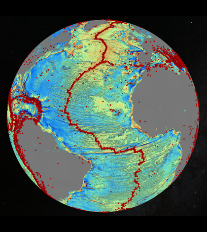
A marine gravity model of the North Atlantic. (Credit: David Sandwell, Scripps Institution of Oceanography, UC San Diego)
A new map from Scripps Institute of Oceanography researchers depicts the global ocean floor in unprecedented detail, according to a report from Scientific American. The map’s resolution is approximately 5 kilometers, making objects 5 kilometers and larger visible.
To create the map, researchers used data from Cryosat-2 and Jason-1 satellites to measure sea surface height, determine the floor’s layout and pick up landscape features. However, the satellites can’t measure the sea floor directly because the water’s interference.
Although the new map is more detailed than previous works, maps of Mars or the moon have higher resolutions. Sonar systems, like those searching for the missing Malaysian Airlines Flight MH730, would be able to provide more detailed pictures, but would need to be closer to the sea floor.
Image: A marine gravity model of the North Atlantic. (Credit: David Sandwell, Scripps Institution of Oceanography, UC San Diego)


0 comments