
In Ararat Basin Of Armenia, Effort Studies Depleted Groundwater
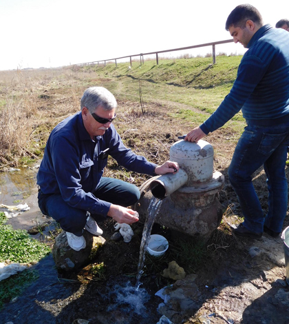
Mark Anderson, director of the USGS South Dakota Water Science Center, demonstrates how to collect a stable isotope sample from a flowing well near Sis, Armenia. (Credit: U.S. Geological Survey)
Thanks to the growth of aquaculture operations to raise sturgeon, trout and other fish in the Ararat Basin of Armenia, the region has seen increased groundwater withdrawals. This has occurred largely over the past 15 years and its impacts aren’t completely known.
There have been visible effects, as some wells in the basin have stopped flowing while others have diminished in output. But there are still many questions that locals have relating to the smart, future management of their water resources.
Scientists with the U.S. Geological Survey (USGS) are looking to help in that effort and have made some headway through a recent trip to the area. The researchers hail from the Survey’s South Dakota Water Science Center and are hoping that their expertise can help build more in-country expertise for groundwater management there and, eventually, help restore the aquifer below.
USGS researchers say that the full consequences of groundwater depletion in the basin aren’t fully known. But they say that land subsidence is a likely outcome. Scientists believe that lake levels there have lowered and that streamflows have also gone down. The depletions may also limit municipal supplies and potentially affect water quality as water from deeper in the aquifer is withdrawn to keep up with demands.
To try and pinpoint some of the possible effects, as well as train Armenian scientists on the ground, the USGS team made a two-week trip to Yerevan, Armenia, where they provided training on data collection to help develop a hydrogeologic plan and groundwater model for the Ararat Basin.
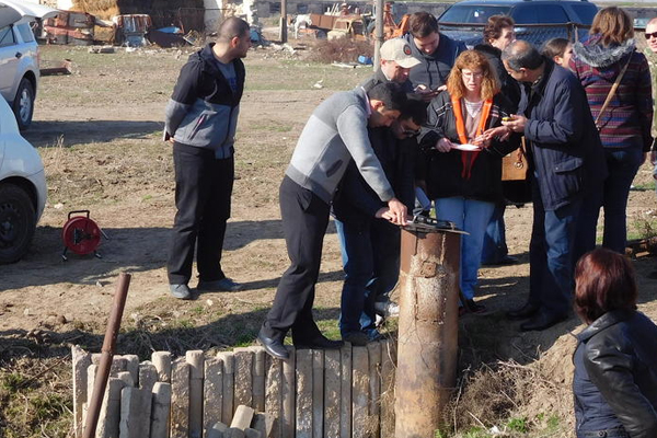
Field training on well inventory and collection of water-level data at a non-flowing well near Yeghegnavan, Armenia, near the Armenia / Turkey / Iran border. Mount Ararat is in the background. (Credit: U.S. Geological Survey)
Working with local Armenian scientists was one of the highlights of the trip, USGS scientists say. The water professionals from Armenia are just beginning to collect data to help with the study and researchers were able to go back to South Dakota with useful information on the aquifer.
As the project progresses, the scientists will measure water levels in both flowing and non-flowing wells throughout the basin to determine water-level changes and areas where wells no longer flow. This information can be used to better understand the status and trends of water levels as a result of competing water uses such as aquaculture, agriculture and municipal supplies.
At the peak of aquaculture in the Ararat Basin, about 260 fish farms were in operation. Several fish farms have since been abandoned leaving behind wells that are still discharging groundwater on the ground. The impacts of all the water lost have been extensive, as about 30 communities have been identified so far with drinking water wells that no longer flow. Other impacts have been felt by the Armenian nuclear power plant, which has had to build new systems to ensure an adequate water supply for cooling.
As for some next steps for the work, USGS scientists think sealing some of the abandoned wells properly could help to conserve more groundwater. Modeling the artesian aquifer in the basin would also be helpful for determining which of the abandoned wells could be most easily sealed while benefiting the aquifer the most.
Support for the work is being provided in part by the U.S. Agency for International Development.
Top image: Mark Anderson, director of the USGS South Dakota Water Science Center, demonstrates how to collect a stable isotope sample from a flowing well near Sis, Armenia. (Credit: U.S. Geological Survey)


0 comments