
Carnegie Institution builds carbon map of Panama
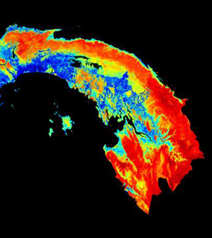
Image: Carbon map of Panama (Credit: Carnegie Institution for Science)
Researchers from the Carnegie Institution for Science have led the way in developing the first high-fidelity map of aboveground carbon density for an entire country, the institute has reported.
Researchers combined field data, satellite images and high-resolution Light Detection and Ranging (LiDAR) data to map vegetation and carbon stocks in the Republic of Panama.
The result was a comprehensive map that provided detailed carbon analysis on both the micro and macro levels. Carbon outputs were accurately mapped in areas as small as a hectare as well as over the entire country.
Being able to successfully map carbon emissions is a step forward in the fight to limit greenhouse gases and slow global warming.
Image: Carbon map of Panama (Credit: Carnegie Institution for Science)


0 comments