
Federal team ready to advise on acoustic stream sediment monitoring
Excess sand and silt is a leading water quality concern for the nation’s waterways, yet the labor-intensive methods for tracking sediment and federal cutbacks in monitoring have limited how well scientists can keep an eye on the issue.
Luckily, a team of federal researchers is ready to advise on projects that keep an ear on the issue–an electronic one, anyway. The Sediment Acoustic Leadership Team will soon issue guidance on how to use acoustic technology to make continuous estimates of sediment concentrations in streams.
Turbidity is the leading cause of impairment in streams across the nation, according to the U.S. Environmental Protection Agency. It’s particularly a problem for fish habitat.
“With sturgeon for example, when they spawn and lay their eggs there is concern about it smothering their eggs before they can become fish,” said Molly Wood, surface water specialist with the U.S. Geological Survey’s Idaho Water Science Center and member of the acoustic leadership team. Wood is also the author of a recently published USGS fact sheet on acoustic sediment monitoring.
Sediment also tends to function as a transport mechanism for pesticides, heavy metals and other contaminants. It’s also an issue for the nation’s reservoirs that are managed for flood control. As sediment accumulates behind dams, the reservoirs loose storage capacity and can’t hold back as much flood waters. Silt and sand can also fill up navigation channels than then require dredging.
Monitoring has been primarily been a time-consuming processes that requires manual sampling. Efforts to tie sediment levels to surrogate variables that are easier to monitor have also been challenging. One strategy involves developing a connection between measured sediment concentrations and streamflow derived from gauging stations, but the relationship between streamflow and sediment can be unreliable, Wood said. That’s especially true in cases where a stream’s flow is controlled by a dam but its sediment source is a downstream tributary.
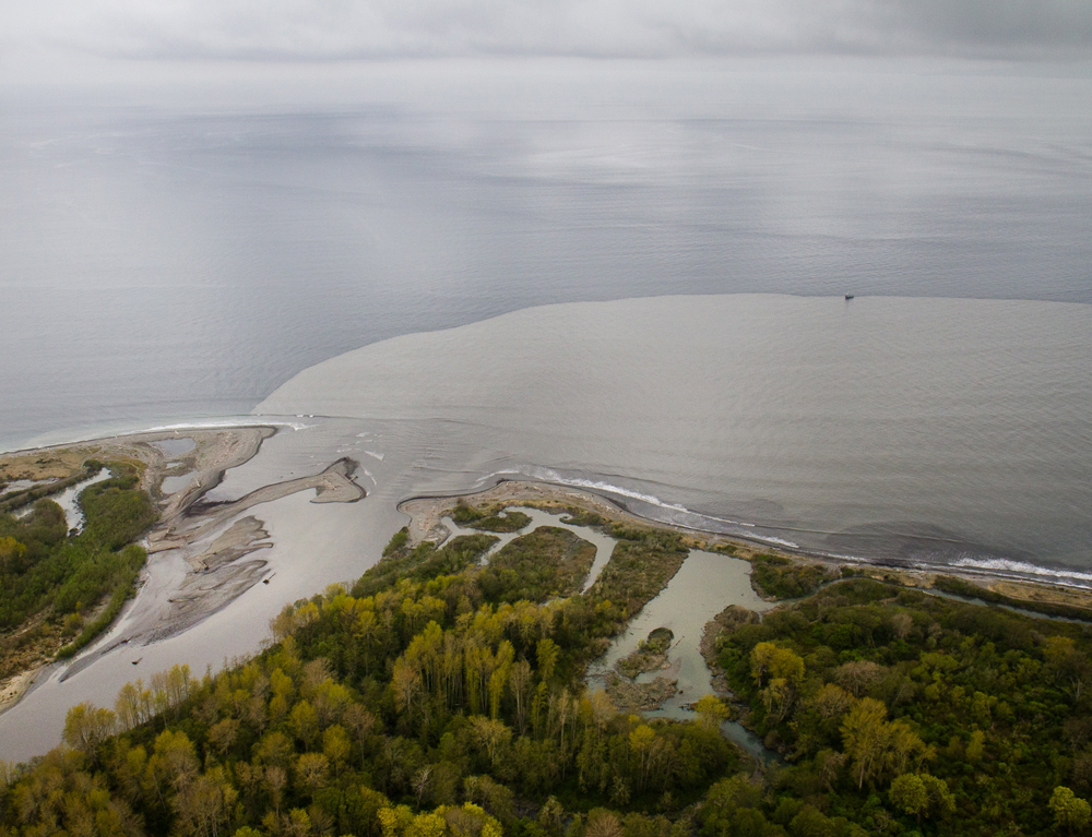
The USGS is using acoustic instruments to estimate sediment loads from the Elhwa and Glines Canyon Dam removals on the Elwha River (Credit: John Felis/USGS)
Other instruments like turbidity proves have so far proven to be high-maintenance, requiring frequent calibrations and sensor wipe downs.
Acoustic Doppler meters, on the hand, have shown great potential for continuous sediment estimates. The tools bounce sound waves off of suspended particles and provide data that are generally used to produced estimates of stream flow and velocity, but they also produce secondary data that can give an indication of the amount of material in the water.
The Sediment Acoustic Leadership Team, with members from the USGS, Army Corps of Engineers and Bureau of Reclamation, has been working on a set of standard practices for instrument installation and data processing that will be available on the team’s website.
“The use of acoustics to estimate sediments has grown tremendously and we’re getting a lot more stations cropping up and we’re hoping to continue that,” Wood said. “There are just a few research questions out there that haven’t been answered, but I don’t think they need to be answered before we can release this guidance to allow people to be doing these kinds of studies in a consistent way.”
Those stations cropping up include a series in the Grand Canyon, where scientists monitor sediment as part of a program of experimental flows from the Glen Canyon Dam meant to rebuild sandbars along the Colorado River. Acoustics are also monitoring sediment in the Elwha River in Washington, where the largest dam removal project in history uncorked a century of accumulated silt sand and gravel.
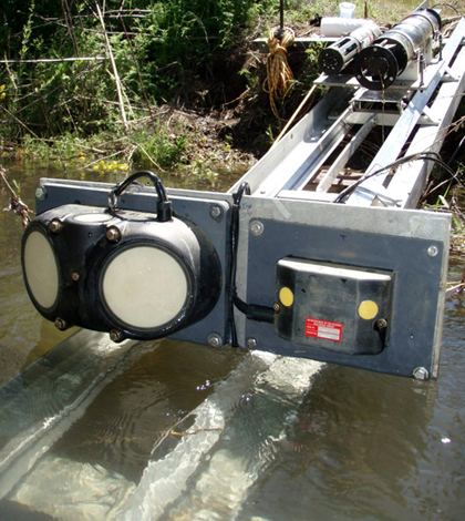
Top image: Sediment surrogate devices, including two acoustic Doppler velocity meters, that were mounted on a track for deployment in the Clearwater River. (Credit: Molly Wood)


0 comments