
NASA’s HS3 hurricane research program peers into severe storms
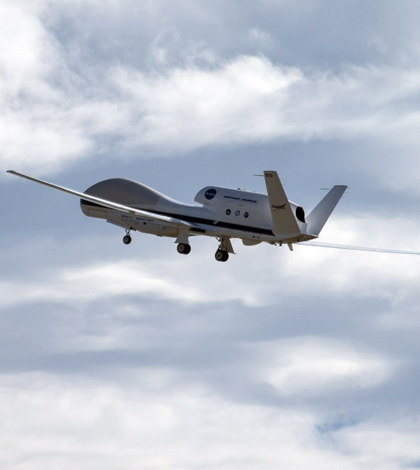
NASA's HS3 hurricane research program makes use of Global Hawk unmanned aircraft (Credit: NASA Wallops/Brea Reeves)
The meteorologists at NASA work in a bit of a paradox: To conduct their research and save lives, they require potentially life-threatening hurricanes to form in the first place.
“I hate to say that we’re hoping for storm activity, but doing these science campaigns, you really need it,” said Scott Braun, research meteorologist at NASA’s Goddard Space Flight Center.
Braun is the principal investigator for the Hurricane and Severe Storm Sentinel program. Shortened as HS3, the program uses remote sensing technology to monitor hurricanes from a safe vantage.
Now in its third year, the HS3 program is deploying new technology to give its researchers insight into the formation and movement of one of nature’s most destructive forces. A pair of space-based observation platforms will complement the operation of two existing unmanned aircraft.
This year’s program will also study the impact of hot Saharan air and dust on hurricanes. Braun hopes that a host of new technology will help find the answer.
The NASA-JAXA Global Precipitation Measurement Core Observatory satellite measures rainfall every three hour across the world. Launched Feb. 27 of this year, the satellite helps scientists understand how storm structure changes over time.
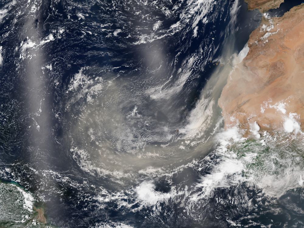
This year’s HS3 program will study the effects of Saharan dust on hurricane formation. This plume blew out over the ocean in August, 2013 (Credit: NASA)
NASA’s second new instrument, the ISS-RapidScat, will launch to the International Space Station in August. The device will collect surface wind data from storms and help forecast marine weather.
“Examining all the instrument data will provide a better understanding of these storms, and hopefully provide improvements in the future,” Braun said.
Two unmanned Global Hawk aircraft will keep an eye on hurricanes in the Atlantic Ocean for the third straight year. Piloted from the Wallops Flight Facility in Wallops Island, Va., the aircraft are equipped with six instruments that paint a comprehensive picture of severe storms. Whereas a manned plane can only sample a storm for about four hours, the unmanned flights can take samples for up to 18 hours
One of the aircraft carries an Airborne Vertical Atmospheric Profiling System, otherwise known as a dropsonde. The system drops a sensor package — attached to a parachute, of course — from the tail of the Global Hawk into the ocean. The sonde measures temperature, humidity, air pressure and wind direction as it falls.
“The dropsonde provides some very valuable information that we can see more or less in real time,” Braun said. The data is then shared with the National Hurricane Center, the U.S. Navy and the National Center for Environmental Prediction for incorporation into forecast models.
“Usually the more data that goes in, the better information you can get,” Braun said. “Dropsonde data has led to some improvements in these models.”
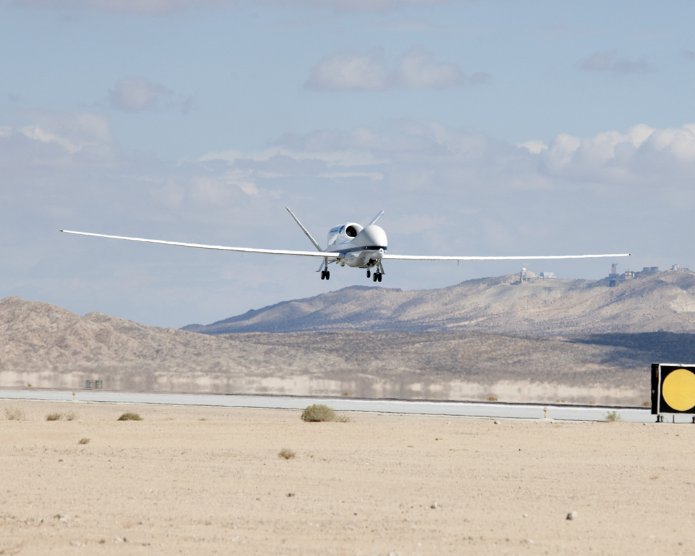
A Global Hawk unmanned aircraft approaches the runway after completing an HS3 mission in 2012 (Credit: NASA/Jim Ross)
The second Global Hawk carries three instruments designed for use above the storm. A down-facing doppler radar unit gathers three-dimensional precipitation information. A microwave sounder and microwave radiometer detect surface wind speed, rainfall rate, temperature and humidity profiles.
The skies haven’t always been so clear for HS3. Braun recalled the earlier days of the program, when complications with the FAA limited flight capabilities.
“They weren’t used to having to deal with the Global Hawk aircraft,” Braun said. “The FAA wanted to see actual flight plans two business days in advance… There’s often a challenge in planning for a hurricane two business days in advance.”
The FAA relaxed their requirements in 2013, only a general outline a storm’s projected path. Braun attributes the improved flexibility to a mutual respect between both agencies.
Braun said other agencies could employ programs similar to HS3 in the future. NOAA seems particularly interested in testing a Global Hawk of their own. For the time being, however, Braun is looking forward to hurricane season in a way that only a meteorologist can.
“Going into the field this year, we feel pretty comfortable that we’ve got a well-defined process,” Braun said. “Now we’re just hoping that the weather cooperates with us.”
Top image: NASA’s HS3 hurricane research program makes use of Global Hawk unmanned aircraft (Credit: NASA Wallops/Brea Reeves)


0 comments