
NASA’s Global Precipitation Measurement mission maps Appalachian Mountains’ rain
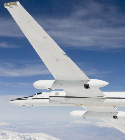
NASA ER-2 aircraft will help the Global Precipitation Measurement Mission collect data in Appalachia's tricky mountain terrain (Credit: NASA)
One year ago, NASA’s Global Precipitation Measurement Mission conducted a ground-based study of rain in Iowa. This year, it has moved on from the flat central plains to the mountainous regions of North Carolina.
The objective of the North Carolina study is to map precipitation from its beginnings in the atmosphere, through its fall to Earth, to its ending points in streams and rivers on land. The current campaign, which began May 1 and runs till June 15, will use rain gauges, radar and disdrometers similar to those used in Iowa to measure precipitation on the ground. Scientists are also deploying research aircraft to study what’s happening inside the clouds.
With a clearer image of those processes, measurements from the Global Precipitation Measurement Core Observatory satellite, launched in February 2014, will be calibrated so that data on precipitation and flooding will be more accurate, helping to improve hydrologic models and advanced-warning efforts in times of disaster.
“The Appalachians receive more precipitation than the area we were in in Iowa,” said Walt Petersen, the mission’s ground validation science manager at NASA. Petersen says that campaign helped them shore up their radar strategy and taught them how to deal with problems that come up during data collection. “With the complexity of the (mountainous) terrain and the effect on the precipitation signal itself, when we connect the dots between what we see from space and the ground, everything is sort of exaggerated.”
That’s because it’s a very difficult area to study. Petersen says some of the winding mountainous zones are missed by equipment set up on the ground. So the aircraft, including NASA’s ER-2 and the University of North Dakota’s Citation II, help fill in the blanks.
“The Citation is sampling precipitation particles in the clouds, from ice to liquid snow to rain drops,” said Petersen. “All of those measurements help us to connect the dots between what we observe from space, how the rain is produced and how much falls to Earth.”
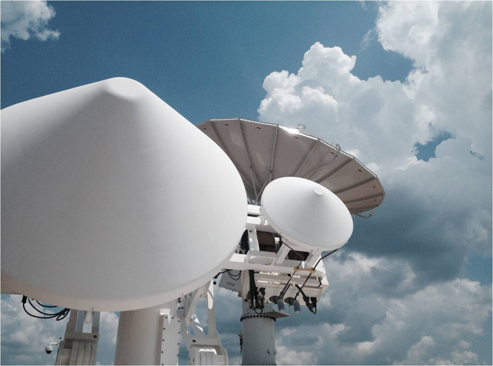
NPOL and D3R radars deployed in Rutherford County, N.C. (Credit: David Wolff/NASA)
Big aircraft are typically used for satellite studies to complete the precipitation picture, says Petersen. Otherwise, research teams are left with an incomplete one. By flying through the clouds to take measurements instead of translating ground-based measurements, it’s possible to know what’s actually happening inside the nebulous bodies.
For the North Carolina campaign, focusing on the Pigeon River and Catawba Watersheds, scientists have added more sensors than were used in Iowa. And they’re using the aircraft to their full potential.
“We do in fact try to get the airplanes up and collecting data at the same time the GPM core satellite passes over,” said Petersen. “That’s the dream scenario and we can do it once or twice during a six-week campaign, but the satellite moves at 7 kilometers a second, so it’s not hanging around for long.”
Partnering with NASA in leading the research effort are Duke University and the National Oceanic and Atmospheric Administration.
Top image: The NASA ER-2 aircraft will help the Global Precipitation Measurement Mission collect data in Appalachia’s tricky mountain terrain (Credit: NASA)


0 comments