
Penn State to study Chesapeake and Delaware bays’ changing land uses
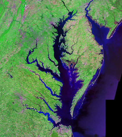
An aerial view of Chesapeake and Delaware bays from the Landsat satellite (Credit: USGS, vis Wikimedia Commons)
A research project led by Penn State University will gauge the effects of population growth and land-use change on the Chesapeake and Delaware Bays, according to a release from the university. The work will be funded by a $1.4 million grant from NASA.
Data from the space agency’s remote sensing satellites will be combined with computer modeling efforts to study changes that have occurred in the area. Researchers will look specifically at the effects of land cover modifications and increasing nitrogen levels in estuaries and nearshore waters.
More than 1 million people live in the watersheds of Chesapeake and Delaware Bays. Also aiding in their study are scientists from Auburn University, the National Oceanic and Atmospheric Administration, Old Dominion University, Rutgers University and the Virginia Institute of Marine Science.
Image: An aerial view of Chesapeake and Delaware bays from the Landsat satellite (Credit: USGS, vis Wikimedia Commons)


0 comments