
Satellite images show methane hotspot in southwestern U.S.
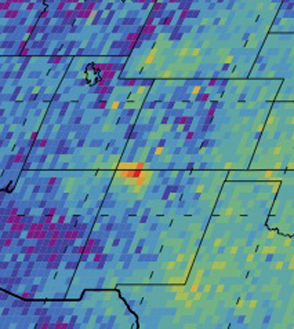
A methane hotspot in the U.S. Southwest appared in satellite data (Credit: NASA/JPL-Caltech/University of Michigan)
A study led by researchers at the University of Michigan has identified a methane hotspot in the southwestern United States, according to The Guardian. The investigation relied on satellite images from 2003 to 2009.
Methane is a potent greenhouse gas, about 86 times more efficient at trapping heat in the atmosphere than carbon dioxide. Knowing where it concentrates is valuable for those working to mitigate its emissions.
Scientists say the high levels of methane found hovering over parts of Kansas, Oklahoma and Texas most likely were pumped out of coal mines. Though at first glance many suspected fracking wells as the cause, data considered for the study were collected years before the recent U.S. fracking boom.
Top image: A methane hotspot in the U.S. Southwest appared in satellite data (Credit: NASA/JPL-Caltech/University of Michigan)


0 comments