
Scientists fly into nor’easter to capture winter storm data
Using a dual-polarization radar developed at the National Center for Atmospheric Research, scientists with the center flew through a nor’easter to record detailed data on winter storms, according to a release. The new radar is capable of distinguishing between ice, water, thin ice and liquid clouds, as well as taking wind measurements.
The field project only lasted a day, Feb. 2, but it covered areas of the U.S. from Washington, D.C. to Bangor, Maine. On that day, the region under study was getting large amounts of snow, freezing rain and strong winds, all of which were of key interest to scientists on the research flight.
“We are hoping to understand how the circulation patterns we saw so clearly on the HIAPER (High-Performance Instrumented Airborne Platform for Environmental Research) Cloud Radar
organize snowfall,” said Bob Rauber, and atmospheric scientist with the University of Illinois, in a statement. “The data from the Nor’easter Project will be valuable to forecasters and researchers studying Northeast snowstorms, helping them interpret the computer model results and observations by ground radar.”
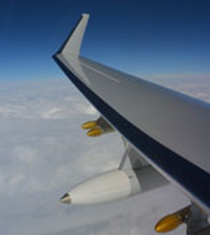
Top image: The HIAPER Cloud Radar, mounted in the white pod, was flown over a Nor’easter to capture data about the winter storm. (Credit: Jonathan Emmett / NCAR)


0 comments