
Scientists plan inexpensive upgrades to California sensor network
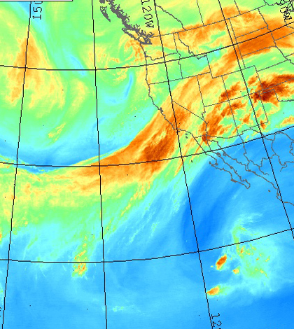
Satellite image of atmospheric river in the eastern Pacific Ocean (Credit: United States Naval Research Laboratory)
A team of California scientists plans to upgrade monitoring stations around the state with inexpensive sensors that could save lives, according to Science Today.
The sensors will be installed on 550 GPS stations throughout Southern California at a cost of less than $5,000 per station. The sensors will detect water vapor and seismic activity, providing early warnings for earthquakes, tsunamis and flood-inducing atmospheric river storms. With the sensors installed, the monitoring stations will report GPS, accelerometer, pressure and temperature data in real time.
Scientists from Scripps Institution of Oceanography, NASA and NOAA discussed the enhancements at the American Geophysical Union Meeting in San Francisco. The enhancements were tested last July during a monsoon event, and proved capable of delivering accurate flash flood warnings.
Image: Satellite image of atmospheric river in the eastern Pacific Ocean (Credit: United States Naval Research Laboratory)


0 comments