
Superstorm Sandy’s reach extended to West Coast
Superstorm Sandy was so powerful that earthquake sensors on the opposite U.S. coastline registered its landfall, according to the Associated Press. The storm, which first hit the East Coast of the country, was felt all the way to the Pacific Northwest.
The sensors typically pick up sudden releases of energy in the Earth’s crust, but they also picked up shaking when Sandy hit. Seismologists at the University of Utah estimated that the energy generated by the storm measured between 2 and 3 magnitudes.
While the seismologists didn’t track Sandy’s strength when the storm hit, they were able to go back and analyze data from before and after landfall. Similar readings were found in California when Hurricane Katrina struck the port city of New Orleans, showing again just how far energy from powerful natural storms can spread.
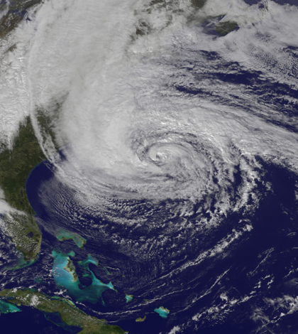
Image: Superstorm Sandy after making landfall on the U.S. East Coast (Credit: NASA)


0 comments