
USGS monitoring river flow, pollutants after Sandy
The U.S. Geological Survey is monitoring water bodies running into the Chesapeake Bay for increased flow and adverse water quality following Super Storm Sandy, according to the agency.
River flows in watersheds feeding the bay were below record highs following the storm, the USGS reported in a release. Still, increased water flow poses a risk for increased sediment scour and runoff of pollutants into watersheds. USGS crews are testing water quality in New Jersey, New York, Pennsylvania, Maryland, Virginia and the District of Columbia.
Pollutants the agency will sample for include nutrients, sediments and pesticides, according to a USGS release on the sampling effort.
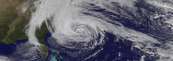
Image: Hurricane Sandy approaching the U.S. East Coast, as captured by the GOES-13 satellite (Credit: NASA Earth Observatory/Robert Simmon)


0 comments