
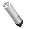
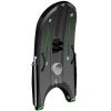
SonTek M9 Acoustic Doppler Profiler
Features
- Highly accurate measurements from 0.06m to 40m depths
- Vertical acoustic beam for superior, highly accurate channel definition
- All discharge computations performed internally - no lost data from communication loss
- Expedited repair and warranty service
- Lifetime technical support
- More
Overview
Introducing the SonTek M9: the ultimate solution for both discharge data and bathymetric surveys. Combining the durability of the RiverSurveyor-M9 with the adaptability of the HydroSurveyor-M9, this all-in-one ADCP offers unmatched flexibility. Designed to excel in various conditions, from floods to dry spells, it eliminates complicated adjustments with automatic handling. Revolutionizing river and canal measurements, the M9 delivers exceptional performance, including velocity mapping and bathymetric surveys. Pair it with HYPACK Environmental Mapping software for a comprehensive solution in a single system.
Technology
The SonTek M9 stands as the trusted choice for leading environmental water monitoring agencies globally, setting new standards in the ADCP industry. It earns its accolades as the pioneer ADCP utilizing multiple frequencies, powered by SonTek's exclusive SmartPulseHD technology. This groundbreaking innovation ensures consistently accurate measurements across various depths, from shallow to deep waters, solidifying its reputation for reliability.
|
Profiling Range — Distance |
0.06 to 40m |
| Profiling Range — Velocity | ±20 m/s |
| Velocity — Accuracy | ±0.25% of measured velocity ±0.2cm/s |
| Velocity — Resolution | 0.001 m/s |
| Number of Cells | Up to 128 |
| Cell Size | 0.02 to 4m |
| Transducer Configuration | Nine (9) Transducers |
| Dual 4-beam 3.0 MHz/1.0 MHz Janus 25° Slant Angle |
|
| 0.5 MHz Vertical Beam Echosounder | |
| Depth — Range | 0.20 to 80m |
| Depth — Accuracy | 1% |
| Depth — Resolution | 0.001 m |
| Discharge Measurement Range — Bottom-Track | 0.3 to 40m |
| Discharge Measurement Range — RTK GPS | 0.3 to 80 m |
| Discharge Measurement — Computations | Internal |
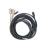
- M9 acoustic Doppler current profiler
- Power supply
- Shipping case
Select Options


In The News
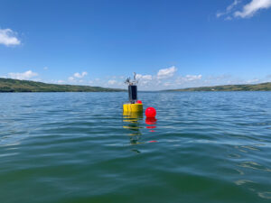
Combating Water Insecurity in Saskatchewan with Real-Time Data
The prairies of Saskatchewan can be described as one of the least water-secure parts of Canada, making water quality monitoring essential for informed resource management in a region already facing water insecurity. While natural physical properties worsen some of the poor water quality conditions in the region, others are connected to land use. Having grown up spending summers on the shores of Lake Huron, Helen Baulch, an associate professor at the School of Environment and Sustainability at the University of Saskatchewan , has always been dedicated to the protection of water resources. Looking back fondly at her childhood playing along the shore, Baulch also recalls the invasion of quagga mussels during her teenage years and watching the lake change as a result.
Read More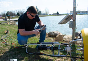
Seametrics Turbo Turbidity Logger: Boost your Turbidity Monitoring
The Seametrics Turbo Turbidity Logger is a self-cleaning turbidity sensor capable of internally logging over 260,000 data records. The sensor enables researchers, compliance officers, and contractors to monitor turbidity in various applications, from construction and dredging sites to wastewater effluent. Due to its narrow width, this device can be deployed in a range of areas, from small well spaces to rivers and streams. The stainless steel housing and built-in wiper allow the sensor to withstand long-term deployments and reduce the need for maintenance trips. The logger accurately records temperature and turbidity up to a depth of 50 meters.
Read More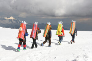
Collecting Data at the Top of the World: How Scientists Retrieve Glacial Ice Cores
A helicopter touches down in the small town of Sicuani, Peru, at an elevation of 11,644 feet. Earlier that day, a boxcar brought fuel, drills, food, and other equipment for a glacial expedition. The year is 1979, and glaciologist Lonnie Thompson is preparing to lead a team to the Quelccaya ice cap in hopes of becoming the first scientists to drill an ice core sample from this glacier. The only problem? The glacier is located at 19,000 feet in one of the most remote areas of the world. The helicopter takes off from the town, but the thin atmosphere at that elevation does not allow it to safely touch down on the ice– due to the aircraft’s weight, and it becomes unstable when the air is less dense.
Read More