
New tide gauge uses satellites to measure sea-level change
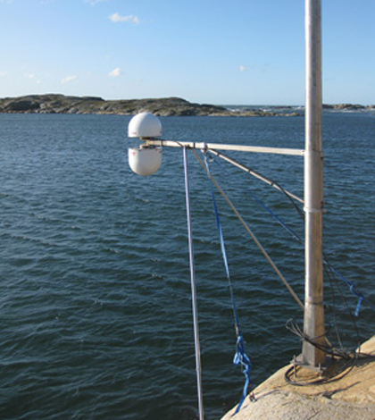
The GNSS tide gauge at Onsala Space Observatory uses signals from satellite navigation systems like GPS to measure the sea level. (Credit: Johan Löfgren)
Scientists at Chalmers University of Technology in Sweden have developed an instrument to measure sea-level change that utilizes satellite navigation systems, according to Phys.org. Their device relies on Global Navigation Satellite System receivers.
Because of this capability, the instrument is called a GNSS Tide Gauge and works by using radio signals from satellites in orbit around the Earth. Two antennas on the device can measure signals directly from satellites and those reflecting off the sea surface to judge changes in its levels.
The tide gauge can also measure changes that occur on land, and is capable of charting short-term land movements like earthquakes. Scientists plan to install one of the new gauges at the Onsala Space Observatory this summer.
Image: The GNSS tide gauge at Onsala Space Observatory uses signals from satellite navigation systems like GPS to measure the sea level. (Credit: Johan Löfgren)


0 comments