
Stanford scientists map saltwater threat to California aquifers
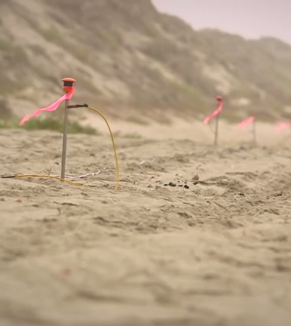
Researchers from Stanford University and the University of Calgary are working to map saltwater intrusion along the coast of California’s Monterey Bay, according to a Stanford release. They’re using a method called electrical resistivity tomography, or ERT.
The scientists place electrodes into sand and then pump tiny impulses of electricity through connecting wires. As the current spreads underground, they then measure the voltage between electrodes, and transfer that measurement into a calculation of resistance.
Since saltwater has a much lower electrical resistivity, scientists can accurately map saltwater intrusion for aquifers in the area. Full results of the mapping effort are expected to be available in 2015.
Top image: Stanford researchers work to map saltwater intrusion along a Californian coast. (Credit: Kurt Hickman)


0 comments