
UC Merced stream study could impact usage regulations
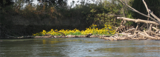
It’s a scene from a pastoral landscape painting: The Merced River flows out of Yosemite National Park, through the majestic Sierra Nevada mountain range and into the fertile San Joaquin Valley. The lower part of the river’s watershed is sought after for high-thrills rafting as well as agriculture. Farmers harness the river to irrigate orchards, vineyards, row crops and dairies in the valley.
Because of the wide variety of human interventions, the Lower Merced River’s ecosystems and biological quality suffer. Water flow levels in the river drastically fluctuate and nutrient concentrations can vary. A group of researchers at the University of California, Merced are monitoring the river’s metabolism to determine its biological response to human activity. Their data could impact guidelines for agriculture and recreation pertaining to the Lower Merced River.
“Making the decision about water allocations is a difficult one when there is not complete understanding of how the river system responds to such a variety of human interventions,” said UC Merced graduate researcher Sandra Villamizar.
 The UC Merced group, lead by engineering professor Tom Harmon, chose to monitor the river by gathering metabolism data rather than the more popular method of simply measuring stream flow, temperature and dissolved oxygen levels. Metabolism data refers to information about the activity of plants and animals in the river. This method analyzes the direct impact of human activities to the ecological community below the surface of the water. Researchers believe that they can physically observe and mechanically quantify a link between human-induced alterations and the river’s metabolism estimates.
If the team’s hypothesis is supported by stream metabolism data, those dependent on the river for recreation and agriculture may have to alter their practices. Reservoir release schedules may change and irrigation drainage practices could experience new regulations. Because the Lower Merced River and its watershed are an archetype of many other regulated rivers around the world, Harmon said the hypothetical changes in guidelines have the potential to be applied in other areas.
“In all but the wettest years, there are competing demands for the water, and the resource must be carefully managed,” Harmon said.
Harmon’s group uses both time and space observations to gather data. Cleverly hidden from vandals in the rusty remains of an old water pump, Harmon said the water quality monitoring equipment acts as a “sentinel in one location, watching all the time.” It measures dissolved oxygen, temperature and other nutrients in the water. Some species, such as the Chinook salmon, found in the Lower Merced, are sensitive to changes in water temperature, which can be affected by effluent.
Knowing what nutrients are in the river, such as nitrogen and phosphorus, can alert researchers of specific types of runoff such as from fertilizers or pastures. Measuring dissolved oxygen is especially important for stream metabolism data. Photosynthesis, the method by which plants make their own food, requires carbon dioxide and releases oxygen as a byproduct into the ecosystem. Animals then breathe in this oxygen and release carbon dioxide as a byproduct. Dissolved oxygen levels can indicate how much plant productivity or community respiration is occurring. Either of these processes could be impeded by poor water quality or toxins.
A NexSens data logger receives measurements from the parameter sensors. At the beginning of the project, Villamizar said the team first used a radio system to transmit data from the river to the lab. However, vegetation blocking the signal and distance challenged the system. They now use a NexSens cellular telemetry system that transmits data to a remote computer.
“This is critical long-term data because we do not always know in advance when a reservoir operation change will happen or when a storm will arrive,” Harmon said. “Even if we did, we would probably not have the resources to scramble and sample very often.”
The team supplements the data from the monitoring station with spot-sampling and observations during bi-weekly rafting trips. These recreational outings are not only a break from lab research, but offer researchers a look at the entire river during different seasons and weather conditions. They are also able to see where outside influences from canals, pumps and groundwater are located in the river’s path.
Unfortunately, these raft trips are occasionally docked due to another one of the Lower Merced River’s inconsistencies – water level. During dangerously high flow periods, the river could reach up to 5,000 cubic feet per second. The river experiences the other extreme during low flow periods, with levels near 10 cubic feet per second.
“During most of the years, except for wet years, this low flow condition occurs simultaneously with the irrigation season and warm periods,” Villamizar said.


0 comments