
Aerial surveys of Washington landslide site spring from university-radar company partnership
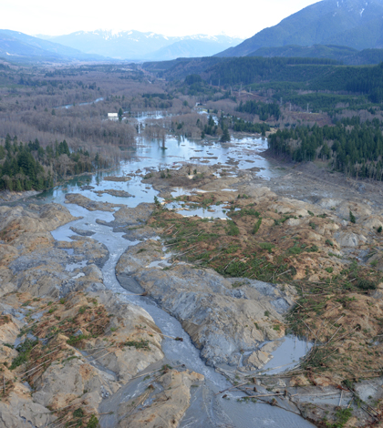
Aerial survey of the Washington mudslide aftermath (Credit: King County Sheriff's Office)
On March 24, two days after the Washington landslide, radar company Artemis Inc. and the University of Washington partnered to conduct aerial surveys of the disaster site, according to a release from the university.
The radar company chipped in some of its topography measuring equipment, while the university provided a research plane. By bringing resources together, scientists were able to create a quick composite image of the disaster zone, mapping things like groundwater and the saturation level of soil.
Data from two survey flights are still being processed and data sets will be made available to the public once ready. Scientists say the data could indicate what caused the slope to fail or if there are still areas of unstable land.
Image: Aerial survey of the Washington mudslide aftermath (Credit: King County Sheriff’s Office)


0 comments