Amateur Mappers Help Nepal Recovery Efforts
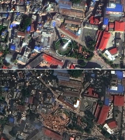
Satellite images before and after the earthquake. (Credit: DigitalGlobe)
Users of a crowdsourced imaging website are helping recovery efforts in Nepal following an earthquake that occurred there in April 2015, according to The Atlantic’s CityLab. The website, Tomnod.com, provides amateur mappers with constantly updating satellite images of the Earth.
The site launched soon after the disappearance of Malaysian Airlines Flight 370. At that time, users helped to provide clues to authorities about the lost airplane’s position by highlighting odd or interesting images. The site’s owners are hoping that its users will show similar interest in aiding the earthquake response.
Images uploaded to the site now cover more than 5,700 square miles. All of them come from a satellite owned by geospatial content company DigitalGlobe.
Top image: Satellite images before and after the earthquake. (Credit: DigitalGlobe)


0 comments