Chesapeake Bay Surface Water Temperatures Rising Faster Than Air Temperatures
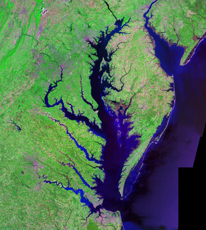
An aerial view of Chesapeake and Delaware bays from the Landsat satellite (Credit: USGS, vis Wikimedia Commons)
The Chesapeake Bay is a highly productive estuary formed by the confluence of freshwater from multiple rivers with saltwater from the Atlantic coast. According to a recent study, parts of the Bay have seen water surface temperatures (WST) rising faster than the surrounding air temperatures, indicating that a heat source other than the air is partially responsible.
The culprit may be the increase in urban land cover from approximately 5 percent to greater than 10 percent since 1975. University of Maryland researchers used the U.S. Geological Survey’s Landsat thermal imaging system to monitor spatial-temporal changes to WST and coastal weather stations to measure air temperatures.
They fed the data into an Annual Temperature Cycle model and compared the estimated WST with actual water temperature measurements. The team found that while maximum WST is influenced most strongly by depth and inputs from rivers, minimum WST is driven primarily by the distance to the ocean.
Top image: An aerial view of Chesapeake and Delaware bays from the Landsat satellite (Credit: USGS)


0 comments