City of Philadelphia tool lets residents find their watershed
By Daniel Kelly on February 11, 2014
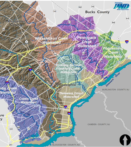
Philadelphia region's major watersheds (Credit: Philadelphia Water Department)
The City of Philadelphia supports a tool that lets residents determine which of the city’s watersheds they live in. The tool, called Find Your Watershed, is on the Philadelphia Water Department website.
It uses a Google Maps interface to give map and satellite views of the seven watersheds in the city. They are color-coded for easy distinction.
Most of the city’s watersheds drain to the Delaware Direct Watershed, which empties into the Delaware River. The river supplies drinking water to more than 15 million people and runs into the Atlantic Ocean.
Image: Philadelphia region’s major watersheds (Credit: Philadelphia Water Department)


0 comments