
Global soil moisture mapped from satellite tools
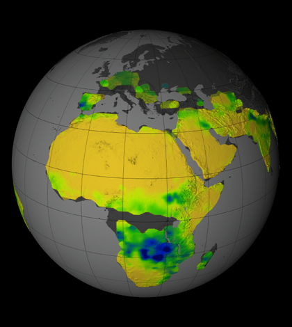
Satellite-derived image of the typical rain pattern for the Africa during the Southern Hemisphere's summer. (Credit: NASA Goddard's Science Visualization Studio/T. Schindler)
Since the summer of 2011, NASA’s Aquarius instrument has monitored soil moisture across the globe. NASA recently released a series of maps derived from that data, according to a NASA press release.
Soil moisture is a vital part of the Earth’s water cycle, as it is necessary for plant life and impacts the global climate system. Scientists can use the new soil moisture maps to prepare for droughts and floods, and to predict agricultural output.
The NASA Soil Moisture Active Passive mission will soon complement Aquarius, providing 10 times the spatial resolution of the current instrument. The European Space Agency is conducting a similar mission called Soil Moisture and Ocean Salinity.
Image: Satellite-derived image of the typical rain pattern for the Africa during the Southern Hemisphere’s summer. (Credit: NASA Goddard’s Science Visualization Studio/T. Schindler)


0 comments