
Monitoring and Protecting Water Quality in Lake Mead, Nevada
Reprinted: YSI Inc.
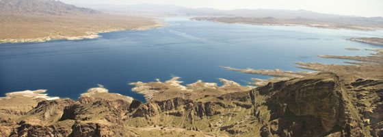
Nevada is America’s driest state. Lake Mead, an impoundment of the Colorado River, lies on the Nevada-Arizona border and is one of the most intensely used reservoirs in the western United States. It provides recreational water activities (such as boating, fishing, and swimming) and domestic drinking, industrial, and irrigation water for over 22 million users – including 1.8 million residents of Nevada and tourists. It is crucial to maintain the lake water quality and level to guarantee a reliable and safe resource for its many uses.
Lake Mead, formed following the completion of Boulder Dam (now called Hoover Dam) in 1935, was the largest artificial lake in the world at that time upon completion. It is one of several reservoirs along the Colorado River; however, due to increases in population and agricultural operations in recent decades, this once-expansive lake in the desert is becoming more compromised.
While inflow into Lake Mead primarily is from the Colorado River, a small percent is also from rivers on the northern side of the Lake and from Las Vegas Wash on the northwest side. Las Vegas Wash transports treated municipal wastewater effluent, stormwater and urban runoff, and shallow groundwater seepage from the Las Vegas urban area to Boulder Basin in Lake Mead.
Effluent flow rates have more than doubled in recent years, prompting concern over potential effects to reservoir water quality, especially since some of the water is pumped for the municipal water treatment plant at Saddle Island.
Near Real-Time Monitoring System
The U.S. Geological Survey (USGS) – in cooperation with the Southern Nevada Water Authority (SNWA), National Park Service (NPS), and the Bureau of Reclamation (BOR) – is monitoring water quality on a near real-time basis at four floating platforms on Lake Mead.
Two monitoring platforms are located in the westernmost Boulder Basin – in Las Vegas Bay and near Sentinel Island; a third platform is located in the Overton Arm near the Overton Marina; and the fourth platform is located in the Virgin Basin, near the Narrows, which separates the Virgin and Boulder Basins. In addition to monitoring water quality, USGS collects meteorological data, such as air temperature, relative humidity, wind direction and speed, solar radiation, and barometric pressure.
Each floating platform, built by the USGS, is approximately 7 by 11 feet and anchored by two 400-pound concrete blocks (a 2-point mooring system). Water quality profiling instrumentation, from Endeco/YSI, profiles the water at different depths throughout the Lake. YSI 6600 water quality probes are equipped with sensors that measure dissolved oxygen, pH, turbidity, depth, temperature, specific conductance, and fluorescence.
The system automatically performs lake water quality profiles at user-defined time intervals and depths. Every 24 hours the USGS office in Henderson, Nevada, downloads data from the platforms to its base station computer.
Monitoring the watershed and analyzing water quality data are crucial steps in maintaining the state’s water quality standards. If parameters such as dissolved oxygen or temperature do not fall within the specified ranges, then the Lake’s beneficial uses are adversely affected. These uses include: propagation of aquatic life including a warm water fishery; recreation; irrigation and watering of livestock; and municipal drinking water supply.
For example, as the level of the lake continues to lower due to high volume usage and reduced inflow, the elevation of the thermocline, a zone that separates a layer of cool water from a layer of warm water, also is lowered. As a result, the drinking water intakes, which are located at fixed elevations, may be exposed to a layer of warmer lake water, which is associated with poorer quality water. This may require increased efforts to treat the drinking water, which may lead to higher treatment costs.
Managing Data and the Changing Environment
Near real-time monitoring can reveal a great deal about water quality. Population growth and construction in Las Vegas have increased the flow and volume of wastewater through the Lake Mead region, causing erosion and flooding. Many other factors can affect the quality of water, such as bacteria, pollution, and large rain events stirring up and moving sediment. The USGS and NPS have even studied the effect of pharmaceutical compounds on aquatic organisms in Lake Mead and Las Vegas Wash.
The large amounts of data collected during continuous monitoring will provide insight into the changes that the region is undergoing.
Researchers are using the data to validate hydrodynamic computer models. Data are used to help understand the fate and transport of water from Las Vegas Wash after it enters the lake.
It will help quantify impacts on water quality in Overton Arm that may be related to urban development. And data logged by the system in Virgin Basin will help assess the impact of warm water inflow from the Colorado River.
Efforts are underway to improve the region’s water quality. Several organizations are working to reduce erosion and silt in the Las Vegas Wash Channel, build wetlands to reduce nutrient loading, perform environmental monitoring, and promote public awareness about this important watershed.
“Lake Mead and water distribution in general in the southwest play a key role in population growth, agriculture, and politics. Preserving its quality and volume is critical to the population and agriculture of this region,” notes Michael Strobel, Ph.D., in the USGS publication Water in Nevada.
For water quality and meteorological data from the Lake Mead monitoring platforms, please visit: http://nevada.usgs.gov/lmqw/index.htm


0 comments