
New blue band on Landsat 8 satellite gives new view of coastal waters
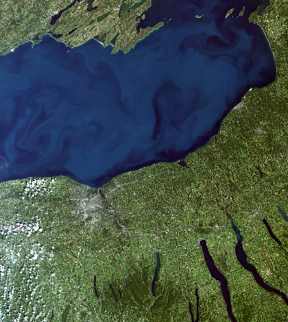
Landsat 8 images of Lake Ontario can show sediment patterns as well as potentially problematic algae. (Credit: NASA/USGS)
Though difficult for most satellites, new sensing technology on the Landsat 8 satellite allows it to detect changes in the colors of coastal waters, according to Space Daily. The capability may help better forecasts of algal blooms.
Oceans and lakes routinely appear dark on satellite images because water very efficiently absorbs light. But with Landsat 8’s new blue band, the satellite can cut down on some of the loss to produce images useful for scientific analysis.
Researchers at the U.S. Geological Survey, which operates Landsat 8, are already using the blue band to study dissolved organic matter, chlorophyll and suspended sediment in the Great Lakes. The advanced tech on Landsat 8 can also detect more variation of light over land, scientists say.
Image: Landsat 8 images of Lake Ontario can show sediment patterns as well as potentially problematic algae. (Credit: NASA/USGS)


0 comments