
New California Water Atlas taking shape
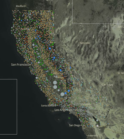
A screenshot of the interactive water rights tool the New California Water Atlas (Credit: New California Water Atlas)
The first California Water Atlas was completed in 1979, and is seen as a landmark accomplishment for the state. But now a new one is being compiled that looks to update the Atlas for current times, according to the Appeal Democrat.
The New California Water Atlas is backed by academics and conservationists who want to bring meaning to the state’s existing data on water. As part of the current effort, government water data will power interactive maps to make it simpler for Californians to access and understand the information.
At least one map has already been created – it shows who owns water rights in the state and where. A few others are in development, including one that depicts water levels in California’s aquifers and another that shows how water prices vary by region.
Image: A screenshot of the interactive water rights tool the New California Water Atlas (Credit: New California Water Atlas)


0 comments