
NOAA launches Great Lakes Environmental Response Management Application tool
A new online mapping tool developed by NOAA aims to provide more accurate information for Great Lakes cleanup and restoration efforts, the organization said in a press release.
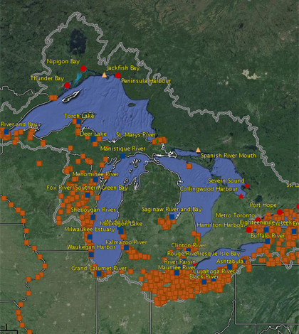
The Great Lakes Environmental Response Management Application tool compiles data on environmental contaminants, natural resources, weather and several other aquatic variables. The tool utilizes both static and real-time data, giving resource managers the ability to observe changes in environmental conditions over time.
The map also provides improved coordination capabilities for emergency responses to events such as oil and chemical spills. The broad range of data sources allows responders to quickly assess an emergency situation and address it appropriately.
Image: Great Lakes Areas of Concern and NOAA Query Manager sediment sampling stations (orange points) shown in Great Lakes ERMA. (Credit: NOAA)


0 comments