Protecting the Caloosahatchee Estuary: Marine Water Quality Systems in Southwest Florida
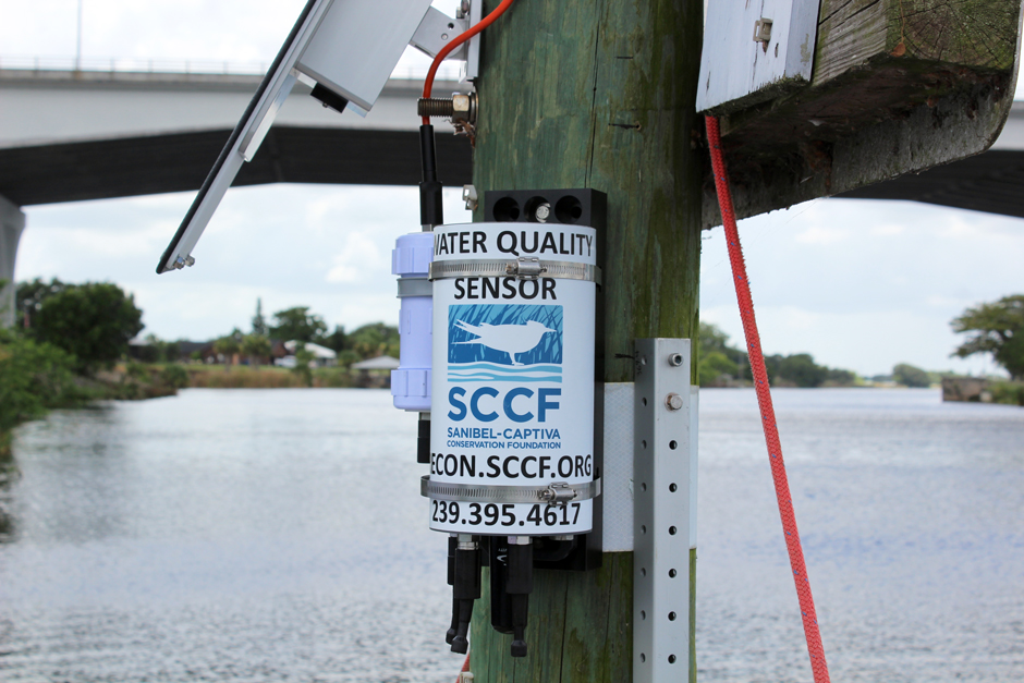 Moore Haven RECON station, with NexSens X2 datalogger and SP-15 power pack. (Credit: AJ Martignette / SCCF)
The southwest Coast of Florida is home to an incredible array of natural wonders, from the Florida Everglades to the Pine Island Sound Aquatic Preserve and the many miles of coastline in between. Yet there is also a high density of urbanization in this region, stretching from Fort Myers to Cape Coral and down to Marco Island, with an estimated population of 1.4 million, much within coastal watersheds, according to the Lee County Economic Development Office.
Many inland rivers that run through this area of the state drain into the Gulf of Mexico. One of these is the Caloosahatchee River, which forms an estuary just past Cape Coral out towards Pine and Sanibel Islands. Once an isolated river, the Army Corp of Engineers connected it to Lake Okeechobee in 1947 for use in flood control.
Now, water that has been polluted by runoff from nearby farms and other human stressors around the lake, which has a watershed of over 4,000 square miles, is sent down the river and into the gulf. This increase in the flow of inland freshwater has caused problems with the load of the river system and is believed to be at the root of deteriorating water quality around the Caloosahatchee Estuary, according to local scientists.
“It’s gone into a manmade system where it didn’t used to be connected […] until the Army Corps connected them,” says A.J. Martignette, a Laboratory Manager at the Sanibel-Captiva Conservation Foundation (SCCF). “Now it’s a managed system and there’s been lots of issues with the demand of that system.”
This water system supplies residents with freshwater, is used in agricultural practices, and has major effects on the ecosystems surrounding the Caloosahatchee Estuary and River. With so many factors contributing to the health of these aquatic ecosystems along the southwest coast of Florida, understanding these factors and working to protect their waters is of the utmost importance to SCCF.
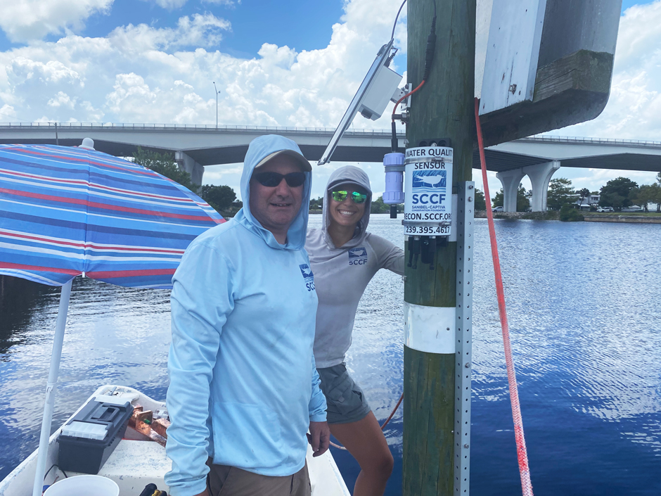
Marine Lab Manager AJ Martignette and Research Assistant Sierra Greene installing the Moore Haven RECON station. (Credit: Denise Blough / SCCF)
Using Marine Water Quality Data to Conserve the Caloosahatchee Estuary
SCCF was founded in 1967 as a land trust and now undertakes projects ranging from wildlife management and habitat restoration to environmental education and water quality monitoring. Martignette has been with SCCF since 2004, and in 2007 took over the then brand-new River, Estuary and Coastal Observing Network, more commonly referred to as the RECON project, which collects data on water quality via eight sites stationed throughout the Caloosahatchee Estuary and River.
Created to “understand the dynamic and changing conditions in the Caloosahatchee,” RECON uses NexSens Technology equipment to aid their research. Some of the data is used to inform the Army Corp of Engineers, which controls water flow out of Lake Okeechobee, about water management decisions. However, SCCF is also involved in many conservation projects on Sanibel Island and the surrounding waters, which can all pull data from RECON.
The RECON project is 16 years old, and despite only being given an estimate of seven years from the manufacturer, SCCF was able to keep its network of original sensors running for 14 years because of a “steadfast maintenance program.” However, in 2021 SCCF was informed that no more replacement parts would be made for their equipment, and the search began for a new manufacturer.
“We needed to upgrade,” states Martignette. “At that point, we went with the NexSens X2 data loggers,” he continues. When deciding between sensors from other manufacturers and NexSens Technology, Martignette explains that NexSens offering to program the data loggers to the specific needs of SCCF before shipping them out was the selling point.
With RECON, SCCF is able to monitor water quality conditions such as water transparency and light intensity, changes in salinity, dissolved organic matter levels, temperature, hypoxic conditions, and more.
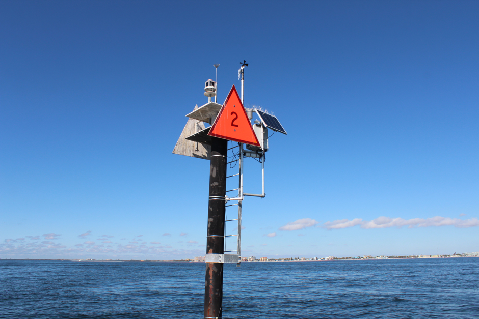
Gulf of Mexico RECON station. In addition to the standard water quality sensors, this site is also equipped with meteorological sensors. (Credit: AJ Martignette / SCCF)
However, this is not Martignette’s first experience with NexSens. He used a previous data logger, the G2 EXO, during past water quality monitoring for SCCF. These G2 loggers are still used in the original wildlife refuge site where monitoring occurred. SCCF also previously used standard X2s at sites measuring water stage and flow for the city of Sanibel.
Moreover, before switching RECON entirely to the X2 platform, SCCF placed X2 data loggers just outside Lake Okeechobee in the Caloosahatchee River. These were used for a separate project in collaboration with the University of Florida (UF) looking at blue-green algae blooms.
Using the real-time capabilities of the X2 data logger and sensors, along with a monthly discrete sampling of phytoplankton, SCCF sends collected data to researchers at UF, who use computer modeling to predict algal blooms and understand their precursors. With this modeling, Martignette hopes their data can help manage and mitigate blooms.
“With this real-time system, if we see a big bloom in chlorophyll, we can go out before that sample and actually get there and get a physical sample and see what’s been in the water,” says Martignette. “So that’s really a great example of how this system is so beneficial compared to a sensor that you put out, get the data, and download it once a month.”
Meanwhile, the coastal RECON project has NexSens systems placed in the Caloosahatchee Estuary, providing essential data to SCCF scientists along with conditions updates for the public. X2 data loggers are useful in marine environments, often deployed on piers or offshore, and SCCF had several options to fit their needs when upgrading the RECON system.
The timing was perfect for the project overhaul, as NexSens had recently come out with the X2-SDLMC Submersible Data Logger. This data logger allowed SCCF to keep using the standard connectors, with enhanced protection from marine conditions.
RECON uses this rugged data logger attached with sensors such as the Seabird HydroCAT CTD, the Seabird ECO Triplet fluorometer, and solar panels, all mounted on a pole in the shallow Caloosahatchee estuary and river mouth waters. In the upper river sites, an additional single-channel ECO is attached to standard X2s, powered by an SP-15 power pack.
With this setup, Martignette and others at SCCF are confident that the data loggers can withstand salty conditions, floods, wave action and more while continuing to collect and transmit data to the WQData LIVE portal.
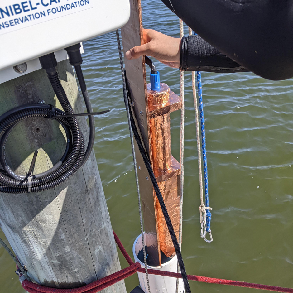
Research Assistant Sierra Greene installing a Seabird Scientific Hydrocat in the deployment well at the Tarpon Bay RECON station. (Credit: AJ Martignette / SCCF)
The Impact of RECONs Systems on Marine Ecosystems
The Caloosahatchee River watershed covers 1,400 miles along with the additional 4,400 miles of watershed from Lake Okeechobee. SCCF believes this incredible amount of area for polluted freshwater runoff from farms and urbanized landscapes to enter the waterways has contributed to habitat destruction and loss of wildlife in the estuary.
The RECON system is used by dozens of scientists at SCCF’s Marine Lab for specific projects across Sanibel Island, the Caloosahatchee Estuary, and other freshwater sampling sites in southwest Florida. Projects include red tide sampling, oyster restoration, nutrient management and a live database reporting water conditions.
Along with scientific uses, the data from RECON’s NexSens equipment informs anglers about water quality conditions, helping them determine where to fish and what may be causing a slow day. Moreover, boaters can get specific weather predictions via sensors connected to the data loggers, forecasting winds, temperature, cloud cover, precipitation and water level.
Conclusion
The success of the RECON project and its popularity with the public is evidenced by the investment made to update the water quality sensor system with NexSens Technology equipment. With NexSens, SCCF continues to use its RECON program to protect the beautiful and indispensable Caloosahatchee Estuary, surrounding water, and islands. The data collected from continual monitoring bolsters SCCF’s public advocacy for conservation, engaging both citizens and elected officials about the importance of conserving southwest Florida’s marine ecosystems.
With such a vast network of water quality monitoring sites, paired with diverse research projects, SCCF needs equipment that can keep up with the demanding work of conservation. NexSens Technology takes the worry out of equipment sourcing and upkeep, offering complete environmental monitoring systems and backend support.
“The great thing about NexSens versus our old system is it’s a complete package,” says Martignette. “You put it out there and it works.” Without worrying about the quality of their equipment, SCCF can focus on working to protect and preserve the surrounding aquatic systems and the communities that rely on them.
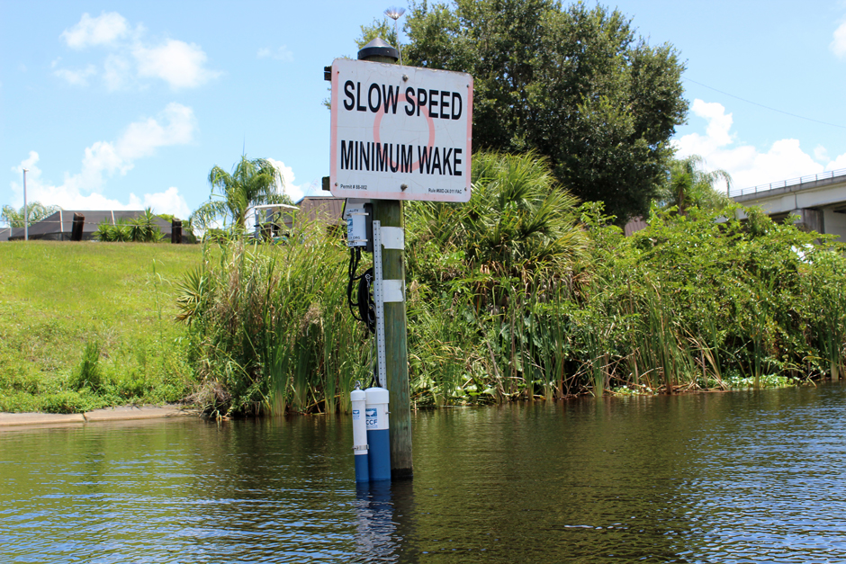
Moore Haven RECON station. (Credit: AJ Martignette / SCCF)


0 comments