
Pursuing Ecology’s ‘Digital Revolution’
“Real-time water quality and flow stations allow Cleveland Metroparks to study urban streams and wetlands in ways previously impossible”
Cleveland’s metroparks are at the receiving end of heavy runoff from surrounding communities. The parks have become catch basins for stormwater, which is impacting aquatic habitat, eroding hundreds of miles of riverbanks, and flushing sediment into Lake Erie.
A study underway by Cleveland Metroparks within the Rocky River watershed is examining the hydrology of the vulnerable headwater streams affected by the runoff, as well as the effectiveness of small wetlands for water storage and water quality improvement. Unlike previous studies, though, researchers are utilizing real-time flow and water quality sensors to attain precise, short-interval hydrograph and water quality data.
Instead of the daily or monthly samples and level measurements used in existing research, the continuous monitoring network provides data every 15 minutes. This level of detail has generated some findings that defy conventional wisdom.
Unforeseen Results
Being able to turn up the unexpected is one of the key advantages to having the continuous, real-time data, noted John Mack, Metroparks’ chief of natural resources.
“With the flow meters, we’re getting actual quantities of water. That level of detail allows us to find stuff that we couldn’t before,” he said. “We sometimes don’t know what we’re going to find, because no one has ever been able to collect this kind of data.”
In fact, after monitoring stations were installed last winter, something about the initial measurements seemed entirely backwards. Existing hydrology literature would suggest flashy hydrographs are more common in urbanized streams than in pristine areas. The data indicated the opposite.
“The first data that came in showed that the more pristine streams tended to be flashier, and more urbanized ones exhibited more of a sustained, drawn-out flow,” said
Cleveland Metroparks Aquatic Biologist Michael Durkalec. “We thought, ‘Well this isn’t what we were expecting or hoping to see.’”
The more familiar trend appeared in the spring, as did a hypothesis for the unexpected winter results. The same impervious surfaces that cause stormwater to surge in the summer also act as giant heat sinks. The research team conjectured that the warm surfaces, along with road salt and other urban inputs, help snow and ice melt as it falls rather than melting all at once when temperatures rise like at pristine sites.
“It makes sense, but that relationship, as far as we know, hasn’t been recognized elsewhere because people aren’t using this kind of equipment with this kind of resolution,” Durkalec said. “It’s a trend we continue to find and make some correlations. It’s kind of a unique find between summer and winter in urban streams that we didn’t really expect.”
Monitoring Technology

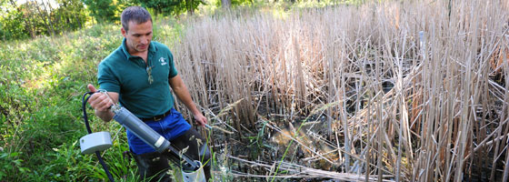
A wetland monitoring station in the 500-acre West Creek Preserve transmits weather, water quality, and hydrology data via real-time cellular telemetry.
Isco 2150 Area Velocity Flow Meters monitor precise water flow data at six primary headwater streams with similar geology, catchment size, fall, and channel width but of varying hydrologic intactness. The sites include two moderately degraded, two severely degraded, and two reference streams.
Furthermore, four water quality and quantity monitoring stations are installed throughout wetlands in the 2,600 acre Rocky River Reservation, with three sites at inlet locations and one at the outlet. Two additional sites are located at wetland outflows in West Creek Preserve, a 500acre natural park. Each of these sites is equipped with an Isco flow meter and a YSI 6920 multi-parameter sonde with temperature, pH, conductivity, ORP, dissolved oxygen, and turbidity probes. Sensors connect to a NexSens data logger with real-time cellular telemetry. By comparing the inlet and outlet data, the research team is able to quantify the wetlands’ exact levels of water storage and effectiveness at reducing pollutants.
The stations are part of a pilot project for monitoring larger watershed restoration projects, Mack said.
“The ultimate goal is to do urban watershed restoration using real short-interval data to track performance,” he said. “We’re trying to figure out how to use the equipment and work out the kinks before using it on a larger scale.”
A “Normal Hydrograph”
Durkalec noted that a primary goal for the project is to gather reference data for small headwater streams in the area, which are often “under the radar” versus monitoring programs for larger waterways.
“A question we’re trying to answer is what a normal hydrograph is for a stream with a three-mile drainage area in our watershed,” Durkalec said. He added that all of the monitoring sites were deliberately placed within the Rocky River watershed so the data would be as comparable as possible.
“We’re trying to come up with a baseline that we can compare other data to as far as what is a healthy hydrograph,” he said. “Interestingly, it looks like it’s going to be seasonally variable. But just having that benchmark, we’re starting to come up with some general curves as to what is normal versus what is a more impaired hydrograph for these streams.”
Urbanization’s Impact on the Metroparks
Increased stormwater runoff resulting from urban development has had a number of undesirable consequences for the parks system and overall watershed health. The unnaturally high flow rates overwhelm headwater streams, which serve as tributaries for larger streams and rivers.
Under normal circumstances, headwaters moderate flow from heavy rains, process nutrients, and reduce sediment. They also provide habitat for unique native flora and fauna in the water and in surrounding riparian habitats. With heavier runoff, however, they are subject to channelization, culverting, and pollution. Additionally, stream bed scouring destroys the habitat used by many native species.
“You often see drastically decreased diversity in these streams,” said Claire Weldon, Metroparks aquatic research coordinator. “Then you have an increase of really tolerant taxa — things like scuds, isopods, and chironomids.”
As a stream becomes urbanized, flashy water can cause increased scouring of substrate and potentially destroy the interstitial spaces within substrate where invertebrates live. Sensitive species like those in the indicator EPT taxa (stoneflies, mayflies, and caddisflies), which require undisturbed habitats to survive, begin to disappear.
Urbanization also introduces chemical changes to these fragile streams. Durkalec identified sodium chloride as a particularly insidious and pervasive pollutant.
“Salt is very persistent in the environment,” he said. “It doesn’t degrade, and it will basically work its way into the water. There are some studies corroborating that it really does have adverse affects on macroinvertebrates in streams.”
Isolated Wetlands and Ecology’s “Digital Revolution”
Mack said he believes that one of the key solutions to the region’s stormwater problem is use of smaller wetlands that are hydrologically isolated, which are highly effective at water removal.
In a previous study he conducted while working for the Ohio Environmental Protection Agency, Mack and colleagues found that small isolated wetlands were capable of removing three to four times the amount of water compared to riverine wetlands.
The isolated wetlands, he said, are capable of retaining water until it is removed through transpiration and evaporation, whereas water can move out of riverine wetlands before this occurs.
The current project’s focus on wetlands is in essence a follow-up to the investigation he conducted with the EPA, Mack said. The previous study lacked a continuous monitoring system and instead involved using portable water level recorders and precipitation data from a local airport. The new level of detail afforded by digital monitoring systems, he said, marks a giant leap in ecological studies.
“This is happening all through ecology,” he said, citing what many are calling the “digital revolution” in the field. “Ecologists are suddenly able to ask questions they never could have asked before.”


0 comments