Seismic Monitor shows global seismic activity through map and data tools
By Daniel Kelly on May 5, 2014
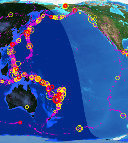
Seismic Monitor display for the Pacific coast on May 5 (Credit: Incorporated Research Institutions for Seismology)
The Seismic Monitor is an online resource showing seismic activity worldwide. The map and toolset are supported by the Incorporated Research Institutions for Seismology.
Within an interactive map, users can break down events like tremors, earthquakes or plate movement for the past five years. Event data can be sorted further to view the last few weeks of activity or that of a single day.
An archive holds seismic data going back to 1970. It contains more than 3.4 million measurements.
Image: Seismic Monitor display for the Pacific coast on May 5 (Credit: Incorporated Research Institutions for Seismology)


0 comments