Tracking ‘Fracking’
Commission monitors shale drilling in Susquehanna River Basin with real-time water quality network
The water quality dangers posed by hydraulic fracturing, or “fracking,” have been of increasing national concern in recent years as natural gas drilling has surged.
Hydraulic fracturing uses the high-pressure injection of millions of gallons of water, sand, and numerous chemicals to fracture rock formations and release the gas deposits within. It makes accessing natural gas deposits thousands of feet underground economical, but it is associated with numerous environmental concerns.
While industry officials say the process is safe, many conservation groups argue that the chemicals used in the fracking fluid, as well as the displaced natural gas, could be contaminating freshwater resources in areas near the drilling. There have been numerous reports of contaminated water, carcinogens in waterways, and even diesel fuel mixed with fracking fluid.
This is especially a concern in Pennsylvania’s portion of the Marcellus Shale, where there has been a boom in drilling over recent years that has threatened the water quality of the region. A notable example is the town of Dimock, Penn., deemed by some the poster child of natural gas drilling gone wrong after reports of exploding water wells and tainted water supplies.
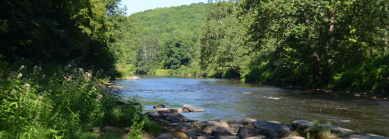
The Marcellus Shale extends throughout much of the Appalachian Basin, from Tennessee to New York. This sedimentary rock holds significant natural gas reserves, and the recent increase in drilling in the area has many worried about how it is affecting water quality in the Susquehanna River Basin.
At the same time, water resource demands throughout the basin are on the rise, making it even more imperative to be able to detect rapid changes in water quality.
In light of the ongoing environmental threat posed by natural gas drilling, an organization called the Susquehanna River Basin Commission proposed in late 2009 the creation of a comprehensive water quality monitoring network that would eventually cover much of the basin.
The SRBC already operated a monitoring system for the Susquehanna River itself. However, the commission aimed to expand the network to continuously monitor and report the conditions of smaller rivers and streams located in the basin, especially in areas experiencing increasing water demands. The commission targeted watersheds with areas typically ranging from 30 to 60 square miles.
Now with more than 40 monitoring stations, the water quality program provides a broad set of data detailing conditions in the basin. The stations wirelessly transmit water quality data to a project computer that then uploads it in real time to the SRBC website. All stations are linked to a single, powerful network that provides vital information about the impact of natural gas drilling and other threats to the quality of water in the region.
The commission chose NexSens Technology to provide the data logging and remote telemetry solution for the network. Each water quality monitoring station includes either a NexSens 3100-iSIC or 6100-iSIC data logger. The 3100-iSIC features a built-in cellular modem, allowing it to transfer data to the project computer over the Internet using a cellular data plan. The 6100-iSIC uses Iridium satellite telemetry, making it suitable for areas in the network that have little or no cellular reception.
All data is easily accessible on a public Web portal generated by NexSens WQData. In addition to making data accessible from any Web browser, this online service allows it to be processed into statistical summaries, graphs, and tables for easy analysis. The Web interface also includes a user-friendly map that displays real-time data from all monitoring sites.
Water quality data may be viewed by officials, scientists, and the public to watch their local rivers and streams for the threat of natural gas pollution as well as any other irregularities in the water. The network is even capable of providing early warnings to environmental officials, helping them to locate the source of water quality issues quickly and respond appropriately.
The first phase of installation began in early 2010 and involved the addition of 30 remote water quality monitoring stations in the northwestern part of the basin, including the border between Pennsylvania and New York where gas drilling was most active. Additionally, some stations were placed in areas where no drilling activities were planned, providing needed control data. A significant portion of the funding came from a $750,000 contribution made by the natural gas company East Resources Inc., based in Warrendale, Penn.
At the end of the same year, work began to expand the monitoring network with 25 additional stations. Ten of them were placed within New York’s portion of the shale and funded by the New York State Energy Research and Development Authority.
Water data is monitored using YSI multi-parameter sondes. Parameters measured include water temperature, conductivity, pH, dissolved oxygen, and turbidity. Data is recorded as frequently as once every five minutes.
Conductivity is especially important, as it correlates with natural gas activity. The conductivity of water containing spilled fracking fluid is typically 200 times greater than normal measurements, according to the SRBC, because of the brine solution used. This makes conductivity a significant indicator of pollution from drilling activities.
Each sonde also includes a built-in depth sensor to help determine the volume of water flow. All data measured by the sondes are collected by the NexSens data loggers and then transmitted to the project computer, which runs NexSens iChart software. iChart interprets all incoming data and posts to the Web in real time.
Continued additions to the network are planned for this year, and the SRBC expects to have a total of 50 stations installed in Pennsylvania and New York by June.
The SRBC was formed in 1970 by the federal government and the states of New York, Pennsylvania, and Maryland with the mandate to protect and manage the water resources of the Susquehanna River Basin.


0 comments