
Western GPS stations show the earth rising as rain stops falling
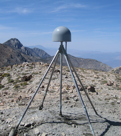
A GPS station in the Inyo Mountains near Lone Pine, California, used to measure uplift (Credit: Shawn Lawrence/UNAVCO, via Flickr)
Severe, ongoing drought in the western United States is draining so much groundwater that earth is rebounding in the West, according to a release from the Scripps Institution of Oceanography. Scientists at the institution have been monitoring the phenomenon since the early 2000s, though data on the rebound were being gathered for the study of earthquakes.
Ground positioning data from GPS stations throughout the West have been collected since 2003. With support from the U.S. Geological Survey, Scripps was able to take a look at the data set spanning more than a decade to see if there had been any elevation changes during that time. What they found was a trend: All of the ground stations had inched upward in recent years.
Data show that recent water shortages are causing an uplift throughout the West, with scientists quantifying a rebound of more than half an inch in California’s mountains and a fifteenth of an inch across the rest of the western states.
“These results quantify the amount of water mass lost in the past few years,” said Dan Cayan, a research meteorologist with Scripps and the USGS, in a statement. “It also represents a powerful new way to track water resources over a very large landscape.”
According to the Los Angeles Times, the analysis considered GPS stations that were located on bedrock or very thin soil because the data from those areas can provide the most accurate measure of groundwater loss that contributes to rebounding earth. And though they weren’t installed for the express purpose of tracking rebound, the GPS stations provided a reliable means to do so.

Data on annual drops in precipitation (above) mirror GPS measurements of uplift (Credit: Scripps Institution of Oceanography, via Flickr)
It appears that the highest uplift is occurring in California’s mountains because there is more water beneath them than other areas. Still, “the thing that is exceptional about this drought is that it really covers the entire region,” said Adrian Borsa, an assistant researcher at Scripps and lead study author, to the Los Angeles Times. “I can’t tell you whether this is as big as earlier droughts, but I would say within the last 10 years, this is definitely an unprecedented change with this drought.”
Researchers figured out how much water needed to be lost to result in the kind of rebound they’re seeing. The result: 63 trillion gallons, or enough to cover the entire western U.S. with four inches of water.

Data from this GPS station near Coalinga, California, were used in the study (Credit: Scripps Institution of Oceanography)
Top image: A GPS station in the Inyo Mountains near Lone Pine, California, used to measure uplift (Credit: Shawn Lawrence/UNAVCO, via Flickr)


0 comments