
Agriculture Research Service validates satellite’s soil moisture data
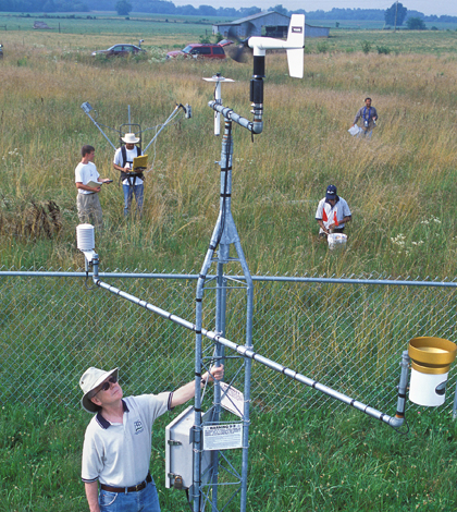
ARS hydrologist Tom Jackson and collaborators collect an array of ground observations to verify the accuracy of satellite data. (Credit: Stephen Ausmus)
Scientists from the U.S. Department of Agriculture found that a European satellite collecting data on soil moisture was 95 percent accurate in comparison to data collected during long-term soil monitoring, according to a USDA release.
Agricultural Research Service scientists tested the validity of the European Space Agency Soil Moisture and Ocean Salinity satellite with data collected at four sites since 2002. There are monitoring stations set up to measure soil moisture in Walnut Gulch, Ariz.; Little Washita, Okla.; Little River, Ga. and Reynolds Creek, Idaho.
During the validation process, the researchers also found that the satellite overestimated soil moisture levels after heavy rains that saturate soil in the afternoon. They were able to identify false readings and compensate for overestimations.
Image: ARS hydrologist Tom Jackson and collaborators collect an array of ground observations to verify the accuracy of satellite data. (Credit: Stephen Ausmus)


0 comments