Ephemeral desert lakes of the Black Rock Playa studied for climate change effects
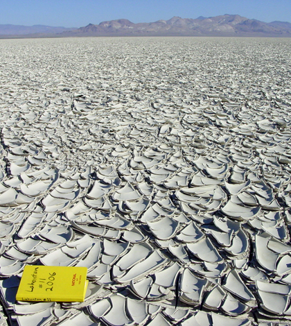
Mud curl deposits left by an evaporating lake (Credit: Kenneth Adams)
Climate scientists are studying the hydrology of quickly vanishing desert lakes to learn more about the hydrologic effects of climate change across the world.
The playa — meaning “beach” in Spanish — is a mineral encrusted landscape found in the arid and semi-arid parts of the world that periodically plays host to shallow lakes. Known also as the salt flat or dry lake, these ephemeral bodies of water are created when rain or snowmelt fills a shallow depression in the playa. The lakes disappear almost as quickly as they form, contributing to the playa’s crust of salt and other minerals.
A December 2013 study, conducted by researchers from the Bureau of Land Management and the Desert Research Institute, originally aimed to quantify the effects that Nevada’s annual Burning Man festival might have on the Black Rock Playa, while also documenting the characteristics and physical processes of the playa.
According to Kenneth Adams, associate research professor at the Desert Research Institute and co-author of the study, two attributes primarily contribute to the lakes’ ability as climate change indicators.
“Because playas lie in the bottoms of closed basins, fluctuations in water level are a direct reflection of the hydrologic balance of of these basins,” Adams said. “And because playas are commonly found in remote areas with little development in their drainage basins, the hydrology of these systems is relatively ‘natural’.”

The Black Rock from which the study site gets its name (Credit: Kenneth Adams)
Adams, alongside co-authors Donald W. Sada and Chris Rosamond, monitored size changes in the lake system of the Black Rock Playa with Landsat satellite imagery spanning the last 40 years. This method, however, provided the researchers with no data regarding the volume of the playa. To attain that information, the researchers conducted field studies using a two-receiver GPS, capable of determining location within a centimeter.
Placing a base receiver at a benchmark location and mounting the other receiver to the roof of his truck, Adams drove across the playa and recorded elevation data every two seconds. After conducting the same survey repeatedly over the course of several days, Adams, Sada and Rosamond had enough data to create a topographic model of the playa at a 10-centimeter scale. This model allowed the researchers to develop associations between surface area, volume and depth.

An erosional scarp created by waves from the playa lake that formed in the spring of 2006 (Credit: Kenneth Adams)
Adams said that although playa lake systems don’t necessarily offer unique knowledge about climate change, their role in the larger climate picture is important to understand.
“These lakes are just one other type of geomorphic system that responds to climate change in their own ways and at their own rates,” Adams said. “It is important to study a variety of physical and biological systems to gain a more complete understanding of the rates and magnitudes of past climate changes, which may shed light on the effects of future climate changes.”
It is the effects of climate change, Adams asserted, and not necessarily the quantifiable change in climatological variables, to which scientists should attribute the greatest importance.
“As a human race, we are conducting a grand experiment, the results of which are still unknown but will probably soon be revealed,” Adams said.


0 comments