
NOAA-engineered PICO Prawler Moorings divide and monitor
Scientists at the National Oceanographic and Atmospheric Administration grew weary of large cumbersome moorings traditionally used to deploy water monitoring technology. So they invented a new model.
Chris Meinig, director of engineering at the NOAA Pacific Marine Environmental Lab where the mooring was developed, jokingly said the team engineered the device after suffering with traditional moorings for years.
Traditional water monitoring moorings are heavy, labor-intensive pieces of equipment. Ship crews have to assemble the rigs at sea and deploy the behemoths with great caution. Rough seas make this task even more difficult and dangerous.
The new NOAA mooring is called the Platform and Instrumentation for Continuous Observation, or PICO. It comes as one compact, preassembled unit with a buoy, mooring line, sensors and anchor.
It arrives on a special pallet, which is not just for the forklift. The pallet attaches to a ship crane to easily deploy the mooring.
Once the device hits the water, the buoy separates from its base, which doubles as an anchor. A spool of cable integrated into the base unwinds as the anchor sinks to the sea floor. Then it gets down to sampling.
There are two versions of the PICO concept. One detects tsunamis with a pressure sensor on the sea floor. Meinig said the sensor is so sensitive it can detect a millimeter of sea level rise. Sheer depth filters out interference from wind or waves.
The other PICO application is for global ocean observations. One instrument on the system is the Prawler. The name is a combination of profiler and crawler, which characterizes the method in which the device takes measurements. A pod of sensors, the size of a coffee can, rides the mooring line continuously; sliding down and crawling up.
The sensor pod travels up the mooring line by harnessing ocean waves with a special cam device. The device, like a ratchet, allows free travel in one direction. In this case, it allows the cable to move toward the sea floor. As the mooring line rises, with a wave, the ratcheting mechanism grabs the line, pulling the pod up.
Special fins on the sensor pod keep it from sinking during upward crawls. One vertical cycle of the sensor pod takes about an hour, according to a NOAA press release.
The beauty of the sensors moving up and down the mooring line is that it gives a vertical profile of information on an area. Sensors on traditional oceanographic moorings, in comparison, take data at fixed points.
Vertical crawling is adjustable but limited to about 1,900 feet of the approximately 15,000 foot cable.
The crawling feature is impressive, but “the secret sauce in the whole thing is really the mooring line,” Meinig said.
Typically mooring lines are full of joints, chains and swivels. The Prawler’s line is all woven into one unit.
Meinig said the line is composed of different sections which are designed for different places in the water. The upper section of the line is protected from shark bites. A plastic casing ensures low friction for the crawler. Below that, there’s shock absorbent line. The lower section is lighter duty floating line. At the anchor, a high-strength section makes sure nothing snaps.
Data gets transmitted from the sensor pod through an inductive modem to the buoy on the ocean’s surface. An iridium satellite modem transmits information back to shore.
Two salinity monitoring Prawlers are currently at sea on the Salinity Processes in the Upper Ocean Regional Study, sponsored by NASA. They are part of a vast array of monitoring instruments being used to calibrate NASA’s Aquarius Satellite.
Meinig said the Aquarius Satellite is very powerful, but it is limited in how deep it can see into the ocean. He describes the satellite’s reach into ocean layers as “skin deep.” The compilation of monitoring equipment on the SPURS mission, Meinig said, should give the satellite better reference, by peering down into the ocean where the action happens.
The PICO Prawler Moorings will be deployed for 14 months collecting data on the SPURS Mission. Meinig said the deployment will be the longest time Prawlers have ever been at sea. “We’re trying to push the endurance level in terms of the quality and fatigue,” Meinig said.
Previously PICO Prawlers have seen up to eight months in the ocean. Meinig said tsunami monitoring versions have seen over three years of constant deployment.
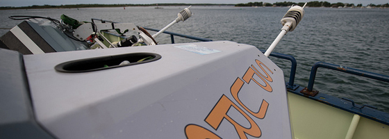
Image: NOAA’s Prawler mooring (Credit: Bill Ingalls/NASA)


0 comments