Nutrient Conditions In Georgia’s Ogeechee River
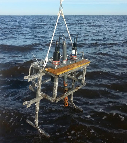
Sondes in the rack getting ready to profile. The rack was scavenged from another project and modified to hold the instruments in place. (Credit: Mike Robinson / University of Georgia)
Nutrient pollution is clearly a problem in United States waters. But what will the issue look like in the future? It’s a tough question to answer, but researchers in many states are approaching it in recent years thanks to a 2013 request from the U.S. Environmental Protection Agency that they adopt nutrient water quality standards.
One of the states at the fore of adopting the standards is Georgia, whose Environmental Protection Division (EPD) has supported work by researchers at the University of Georgia’s Skidaway Institute of Oceanography to study nutrients pulsing through the Ogeechee River estuary. The goal is to gather a lot of quality data for use in modeling that can predict how conditions may change there in the future. Data may be useful elsewhere in the region, as it is similar to other estuaries lined with salt marshes along the state’s coast.
For those at the university, the river was an ideal spot for sampling because of its location nearby. Past researchers at Skidaway have also already sampled the river, providing some useful background on its conditions.
Studying the Ogeechee River’s nutrients relied heavily on the use of a research vessel that investigators drove down the waterway at a pace of about 8 knots as the tide was coming in. Onboard, a suite of sensors gathered critical data on parameters including chlorophyll, dissolved oxygen, colored dissolved organic matter, fluorescence, conductivity, temperature and depth.

The rack setup while underway. The white plastic tube delivers water from the bilge pump. A separate pick-up pumps water through a SeaBird CTD inside the white cylinder. (Credit: Mike Robinson / University of Georgia)
“Eight knots is about 10 mph,” said William Savidge, assistant professor of oceanography at Skidaway. “So we were moving at a brisk trot.”
That pace to keep up with the tide helped researchers to account for the channel itself. If waters were too high, they would essentially not be sure that they were sampling where they needed to. But going with the tide also took the surrounding salt marshes into consideration.
Savidge says that he and others involved, including Kate Doyle, a researcher at Skidaway, wanted to ensure that whatever the marshes added was assessed at low tide.
“When the marshes flood, there is a net change in the amount of chlorophyll — marshes contain a good bit — and they contribute organic matter,” said Savidge. “We wanted to make sure we captured the contributions of marshes at low tide after the fact, after they’d drained … If we had sampled on a high tide, we might have missed the contributions of processes happening on the flooded marsh surface (such as removal of chlorophyll or addition of phosphate). Everything is confined and concentrated in the channel at low tide.”
Measuring those and the larger dynamics at play in the surface waters of the Ogeechee River estuary took a great number of instruments rigged up to sample in a flow-through system. Water was drawn through tubing mounted through a bilge pump on the side of the ship and passed through a WET Labs FLNTU (combines fluorescence and turbidity), a fluorometer and a YSI 600 OMS Optical Monitoring Sonde. A nearby tube held an S::CAN absorbance spectrometer for tracking photodegradation of organic matter as it moves downstream. A Seabird CTD (conductivity, temperature, depth) sensor was also used.
In the Ogeechee River, the total number of sampling runs was 10, including two per quarter for a year and an additional two opportunistic runs that were completed to take advantage of boat time while the craft was in use for another study. A few profiling runs using the same instruments were also completed in the Altamaha River, Savidge says, to support additional studies going on at the University of Georgia, Athens.
Researchers found that the upper estuary is mostly freshwater, while the lower half is more salty. Near a loop in the middle, there’s a transition.

Near the mouth of the Ogeechee River estuary. (Credit: Mike Robinson / University of Georgia)
“We’re seeing all the usual estuarine gradients (in one transect from August),” said Savidge. “We are seeing some evidence of hotspots. There are high concentrations of chlorophyll occurring between a sharp transition to freshwater at the end of the river. High chlorophyll is associated with changes in CDOM. Downstream, there are significant changes in salinity. There are almost two estuarine systems.”
Data on organic matter and absorption haven’t been fully processed yet. But Savidge expects they may reveal a degradation of organic matter as it moves downstream. Woodlands and marshes along the river help to contribute a lot of that matter, he says.
As for some unexpected results, Savidge notes that there’s a very strong drawdown of chlorophyll in the middle of the estuary in the summer. There’s also a coinciding peak in concentrations of nitrites and phosphates. He’s likewise registered a big change on the 15N (isotope of nitrogen) side of some particulate organic nitrogen fractions.
“Suggests to me that there is a very active nutrient recycling zone in the middle estuary in the summer. But by late fall (December) through our last spring sampling in late April, the river properties look mostly conservative with most gradients indicative of simple dilution of a riverine source through the estuary,” said Savidge. “I was surprised at how fast the summer – fall transition was. And I was surprised by how strong the summer chlorophyll drawdown was.”
Those results and others will be highly useful for water managers at the state Environmental Protection Division. They are largely focused on nutrient loads and their effects across much of Georgia’s coast.
“We’ve got five rivers going into the coast. Each has a main estuary and the whole system is connected by marshes and channels,” said Savidge. “We’re not going to get answers by just looking at data. The EPD is putting together an estuarine model and we’re ultimately providing food for their modeling efforts. It would take a decade of data collection to do otherwise.”
Top image: Sondes in the rack getting ready to profile. The rack was scavenged from another project and modified to hold the instruments in place. (Credit: Mike Robinson / University of Georgia)


0 comments