Pacific Islands Buoy Back Gathering Real-Time Wave Data
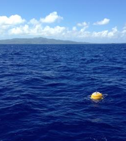
PacIOOS wave buoy off Tanapag, Saipan. (Courtesy of the University of Hawaii)
The Pacific Islands Ocean Observing System includes a network of 14 buoys which gather ocean and wave information in real time. According to a recent press release from the University of Hawaii at Manoa, one of the buoys was recently redeployed to the ocean 5 miles from Tanapag, Saipan, and is back at work providing up-to-the minute information to area residents and workers.
The other 13 buoys gather data for a variety of locations in the Pacific Islands, such as the sea surrounding the Mariana Islands. The buoys gather real-time wave height, direction, period and sea surface temperature information that anyone can access online.
Fishermen, boaters, swimmers and commercial operators can regularly access the data provided by the buoys to get information on waves and water conditions. The data indicate where ocean activities may be safely performed and where conditions might be best, and are used in surf reports, wave forecasts, warnings and small craft advisories.
Top image: PacIOOS wave buoy off Tanapag, Saipan. (Courtesy of the University of Hawaii)


0 comments